KZA KN.KZA - Earthquake Result Viewer
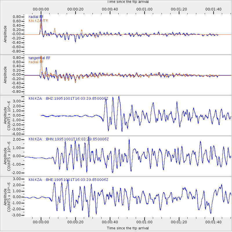
Earthquake location: Turkey
Earthquake latitude/longitude: 38.1/30.2
Earthquake time(UTC): 1995/10/01 (274) 15:57:16 GMT
Earthquake Depth: 33 km
Earthquake Magnitude: 5.7 MB, 6.1 MS, 6.3 UNKNOWN, 6.0 MW
Earthquake Catalog/Contributor: WHDF/NEIC
Network: KN Kyrgyz Seismic Telemetry Network
Station: KZA KN.KZA
Lat/Lon: 42.08 N/75.25 E
Elevation: 3520 m
Distance: 34.4 deg
Az: 68.87 deg
Baz: 278.698 deg
Ray Param: 0.07769728
Estimated Moho Depth: 35.25 km
Estimated Crust Vp/Vs: 1.87
Assumed Crust Vp: 6.306 km/s
Estimated Crust Vs: 3.372 km/s
Estimated Crust Poisson's Ratio: 0.30
Radial Match: 93.7351 %
Radial Bump: 382
Transverse Match: 73.28468 %
Transverse Bump: 400
SOD ConfigId: 6273
Insert Time: 2010-03-08 20:37:09.519 +0000
GWidth: 2.5
Max Bumps: 400
Tol: 0.001

Signal To Noise

ChannelStoNSTALTA
KN:KZA: :BHN:19951001T16:03:29.850006Z1.17114694.326645E-73.694366E-7
KN:KZA: :BHE:19951001T16:03:29.850006Z0.963336351.3860769E-71.4388296E-7
KN:KZA: :BHZ:19951001T16:03:29.850006Z1.78060691.3351239E-77.498139E-8
Arrivals
Ps5.2 SECOND
PpPs15 SECOND
PsPs/PpSs20 SECOND