You are here: Home > Network List > US - United States National Seismic Network Stations List
> Station MSO Missoula, Montana, USA > Earthquake Result Viewer
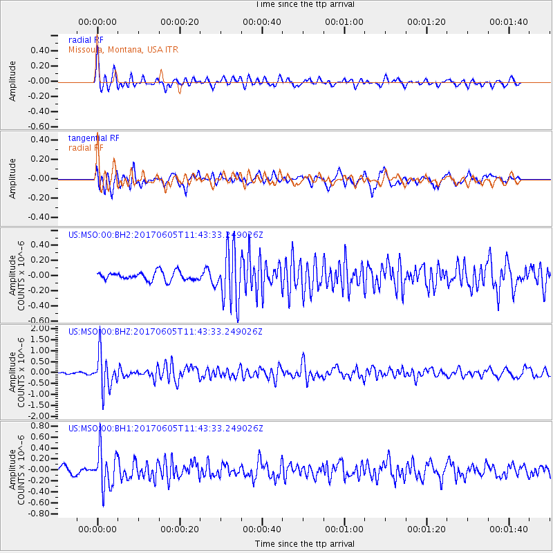
MSO Missoula, Montana, USA - Earthquake Result Viewer
*The percent match for this event was below the threshold and hence no stack was calculated.
| Earthquake location: |
Peru-Ecuador Border Region |
| Earthquake latitude/longitude: |
-4.1/-80.4 |
| Earthquake time(UTC): |
2017/06/05 (156) 11:34:11 GMT |
| Earthquake Depth: |
51 km |
| Earthquake Magnitude: |
5.6 Mww |
| Earthquake Catalog/Contributor: |
NEIC PDE/us |
|
| Network: |
US United States National Seismic Network |
| Station: |
MSO Missoula, Montana, USA |
| Lat/Lon: |
46.83 N/113.94 W |
| Elevation: |
1264 m |
|
| Distance: |
58.7 deg |
| Az: |
333.638 deg |
| Baz: |
139.829 deg |
| Ray Param: |
$rayparam |
*The percent match for this event was below the threshold and hence was not used in the summary stack. |
|
| Radial Match: |
74.58942 % |
| Radial Bump: |
400 |
| Transverse Match: |
74.24397 % |
| Transverse Bump: |
400 |
| SOD ConfigId: |
2140511 |
| Insert Time: |
2017-06-19 03:30:29.875 +0000 |
| GWidth: |
2.5 |
| Max Bumps: |
400 |
| Tol: |
0.001 |
|
Signal To Noise
| Channel | StoN | STA | LTA |
| US:MSO:00:BHZ:20170605T11:43:33.249026Z | 9.84829 | 8.1652405E-7 | 8.291023E-8 |
| US:MSO:00:BH1:20170605T11:43:33.249026Z | 6.451888 | 3.4767734E-7 | 5.3887693E-8 |
| US:MSO:00:BH2:20170605T11:43:33.249026Z | 6.375103 | 3.56391E-7 | 5.590357E-8 |
| Arrivals |
| Ps | |
| PpPs | |
| PsPs/PpSs | |


