KZA KN.KZA - Earthquake Result Viewer
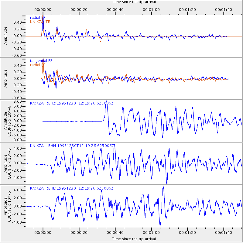
Earthquake location: Off East Coast Of Honshu, Japan
Earthquake latitude/longitude: 40.8/143.4
Earthquake time(UTC): 1995/12/30 (364) 12:11:07 GMT
Earthquake Depth: 33 km
Earthquake Magnitude: 5.7 MB, 6.2 MS, 6.4 UNKNOWN, 6.3 MW
Earthquake Catalog/Contributor: WHDF/NEIC
Network: KN Kyrgyz Seismic Telemetry Network
Station: KZA KN.KZA
Lat/Lon: 42.08 N/75.25 E
Elevation: 3520 m
Distance: 49.8 deg
Az: 295.293 deg
Baz: 67.237 deg
Ray Param: 0.06838773
Estimated Moho Depth: 59.5 km
Estimated Crust Vp/Vs: 1.77
Assumed Crust Vp: 6.306 km/s
Estimated Crust Vs: 3.553 km/s
Estimated Crust Poisson's Ratio: 0.27
Radial Match: 97.05397 %
Radial Bump: 400
Transverse Match: 93.96432 %
Transverse Bump: 400
SOD ConfigId: 6273
Insert Time: 2010-03-08 20:37:18.504 +0000
GWidth: 2.5
Max Bumps: 400
Tol: 0.001

Signal To Noise

ChannelStoNSTALTA
KN:KZA: :BHN:19951230T12:19:26.625006Z4.03492164.526745E-71.1218916E-7
KN:KZA: :BHE:19951230T12:19:26.625006Z9.7230296.173158E-76.349006E-8
KN:KZA: :BHZ:19951230T12:19:26.625006Z20.0178891.782291E-68.9034906E-8
Arrivals
Ps7.7 SECOND
PpPs25 SECOND
PsPs/PpSs32 SECOND