KZA KN.KZA - Earthquake Result Viewer
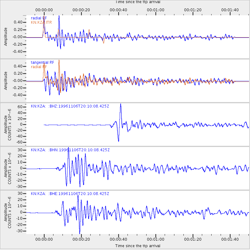
Earthquake location: Bonin Islands, Japan Region
Earthquake latitude/longitude: 28.0/143.5
Earthquake time(UTC): 1996/11/06 (311) 20:00:58 GMT
Earthquake Depth: 9.0 km
Earthquake Magnitude: 6.4 MB, 6.5 MS, 6.6 UNKNOWN, 6.4 ME
Earthquake Catalog/Contributor: WHDF/NEIC
Network: KN Kyrgyz Seismic Telemetry Network
Station: KZA KN.KZA
Lat/Lon: 42.08 N/75.25 E
Elevation: 3520 m
Distance: 56.3 deg
Az: 303.728 deg
Baz: 81.058 deg
Ray Param: 0.064255774
Estimated Moho Depth: 52.0 km
Estimated Crust Vp/Vs: 1.95
Assumed Crust Vp: 6.306 km/s
Estimated Crust Vs: 3.238 km/s
Estimated Crust Poisson's Ratio: 0.32
Radial Match: 95.7044 %
Radial Bump: 400
Transverse Match: 93.79999 %
Transverse Bump: 400
SOD ConfigId: 6273
Insert Time: 2010-03-08 20:37:21.421 +0000
GWidth: 2.5
Max Bumps: 400
Tol: 0.001

Signal To Noise

ChannelStoNSTALTA
KN:KZA: :BHN:19961106T20:10:08.425Z0.557111141.3653381E-72.4507463E-7
KN:KZA: :BHE:19961106T20:10:08.425Z1.81094363.0645506E-71.6922397E-7
KN:KZA: :BHZ:19961106T20:10:08.425Z1.83961841.7921701E-79.742075E-8
Arrivals
Ps8.2 SECOND
PpPs23 SECOND
PsPs/PpSs31 SECOND