KZA KN.KZA - Earthquake Result Viewer
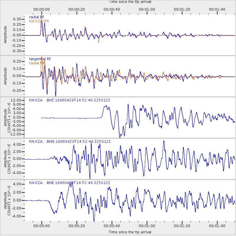
Earthquake location: Solomon Islands
Earthquake latitude/longitude: -6.5/155.0
Earthquake time(UTC): 1996/04/29 (120) 14:40:41 GMT
Earthquake Depth: 44 km
Earthquake Magnitude: 6.3 MB, 7.5 MS, 7.2 UNKNOWN, 6.8 ME
Earthquake Catalog/Contributor: WHDF/NEIC
Network: KN Kyrgyz Seismic Telemetry Network
Station: KZA KN.KZA
Lat/Lon: 42.08 N/75.25 E
Elevation: 3520 m
Distance: 86.8 deg
Az: 312.798 deg
Baz: 101.673 deg
Ray Param: 0.043740477
Estimated Moho Depth: 18.75 km
Estimated Crust Vp/Vs: 1.60
Assumed Crust Vp: 6.306 km/s
Estimated Crust Vs: 3.941 km/s
Estimated Crust Poisson's Ratio: 0.18
Radial Match: 96.05968 %
Radial Bump: 400
Transverse Match: 93.40447 %
Transverse Bump: 400
SOD ConfigId: 6273
Insert Time: 2010-03-08 20:37:48.469 +0000
GWidth: 2.5
Max Bumps: 400
Tol: 0.001

Signal To Noise

ChannelStoNSTALTA
KN:KZA: :BHN:19960429T14:52:49.325012Z2.16459015.8712406E-82.712403E-8
KN:KZA: :BHE:19960429T14:52:49.325012Z4.60076671.7272735E-73.754317E-8
KN:KZA: :BHZ:19960429T14:52:49.325012Z10.983938.082599E-77.3585674E-8
Arrivals
Ps1.8 SECOND
PpPs7.5 SECOND
PsPs/PpSs9.4 SECOND