
KZA KN.KZA - Earthquake Result Viewer
| ||||||||||||||||||
| ||||||||||||||||||
| ||||||||||||||||||
|
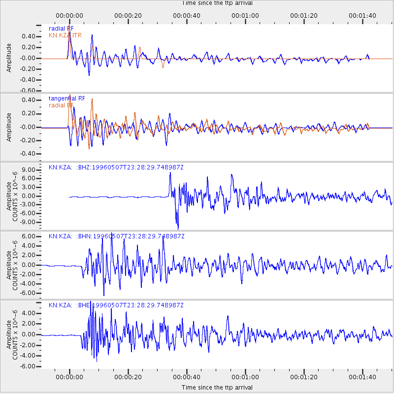
Signal To Noise
| Channel | StoN | STA | LTA |
| KN:KZA: :BHN:19960507T23:28:29.748987Z | 8.580973 | 6.8558876E-7 | 7.989639E-8 |
| KN:KZA: :BHE:19960507T23:28:29.748987Z | 16.97325 | 6.185301E-7 | 3.644147E-8 |
| KN:KZA: :BHZ:19960507T23:28:29.748987Z | 21.450125 | 2.185112E-6 | 1.0186943E-7 |
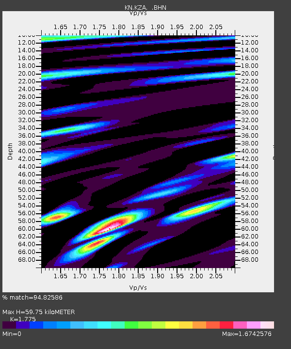
| Arrivals | |
| Ps | 7.8 SECOND |
| PpPs | 25 SECOND |
| PsPs/PpSs | 33 SECOND |

