
KZA KN.KZA - Earthquake Result Viewer
| ||||||||||||||||||
| ||||||||||||||||||
| ||||||||||||||||||
|
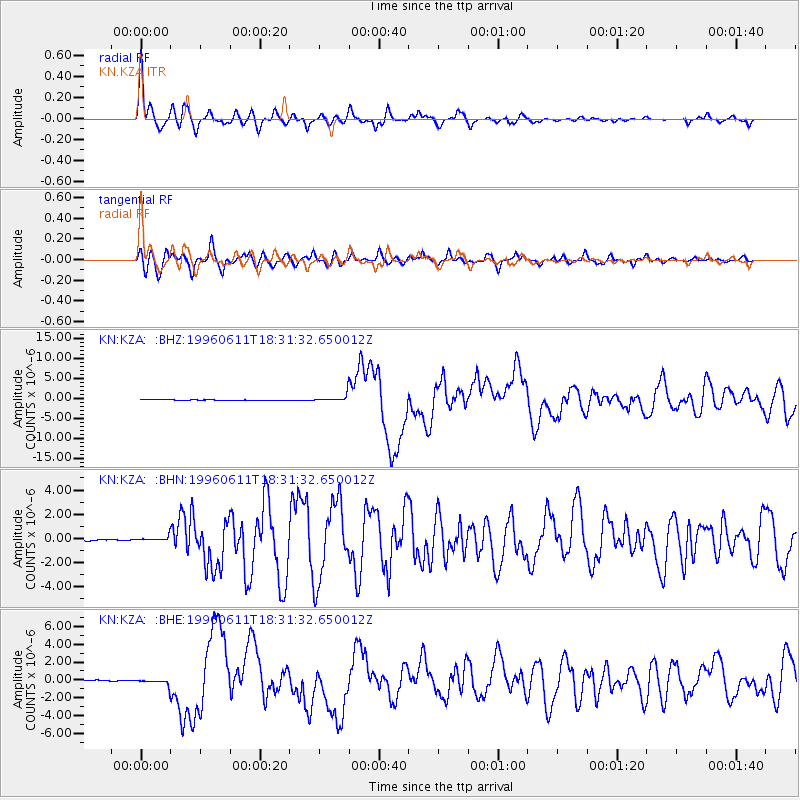
Signal To Noise
| Channel | StoN | STA | LTA |
| KN:KZA: :BHN:19960611T18:31:32.650012Z | 4.4783373 | 2.0137922E-7 | 4.4967408E-8 |
| KN:KZA: :BHE:19960611T18:31:32.650012Z | 8.727824 | 3.5023697E-7 | 4.0128782E-8 |
| KN:KZA: :BHZ:19960611T18:31:32.650012Z | 18.800434 | 9.835646E-7 | 5.231606E-8 |
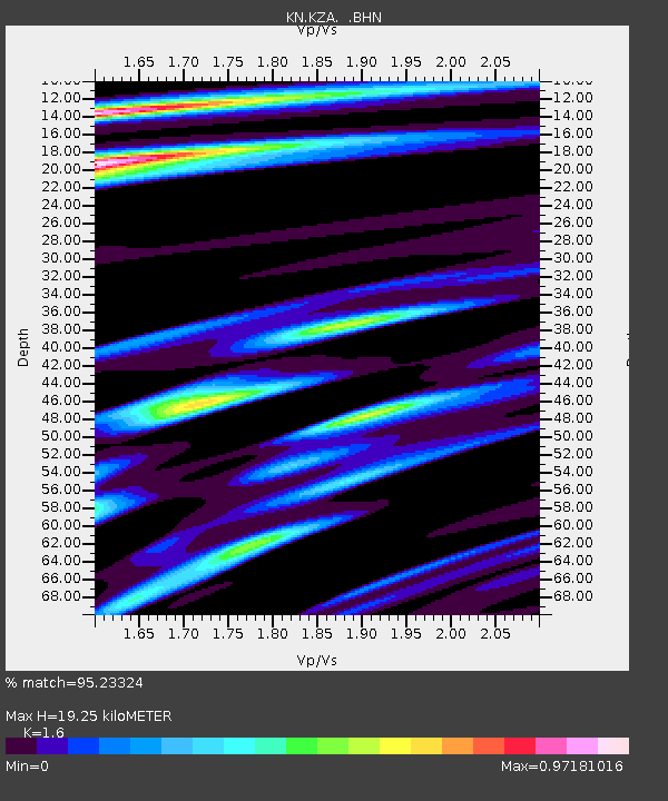
| Arrivals | |
| Ps | 1.9 SECOND |
| PpPs | 7.5 SECOND |
| PsPs/PpSs | 9.4 SECOND |

