
KZA KN.KZA - Earthquake Result Viewer
| ||||||||||||||||||
| ||||||||||||||||||
| ||||||||||||||||||
|
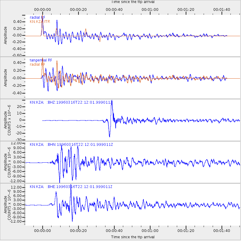
Signal To Noise
| Channel | StoN | STA | LTA |
| KN:KZA: :BHN:19960316T22:12:01.999011Z | 0.71416616 | 9.315712E-8 | 1.304418E-7 |
| KN:KZA: :BHE:19960316T22:12:01.999011Z | 8.380394 | 3.7571476E-7 | 4.483259E-8 |
| KN:KZA: :BHZ:19960316T22:12:01.999011Z | 17.916458 | 9.5223317E-7 | 5.314852E-8 |
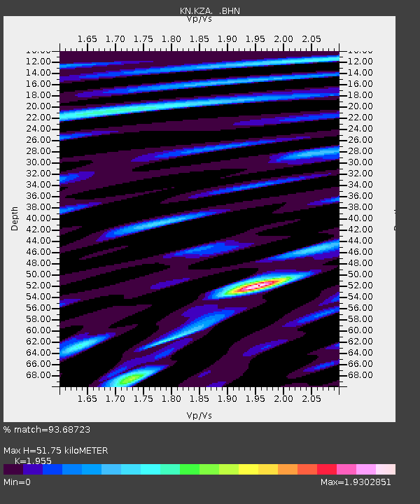
| Arrivals | |
| Ps | 8.2 SECOND |
| PpPs | 23 SECOND |
| PsPs/PpSs | 31 SECOND |

