You are here: Home > Network List > TA - USArray Transportable Network (new EarthScope stations) Stations List
> Station H31M Peel River, Yukon, CAN > Earthquake Result Viewer
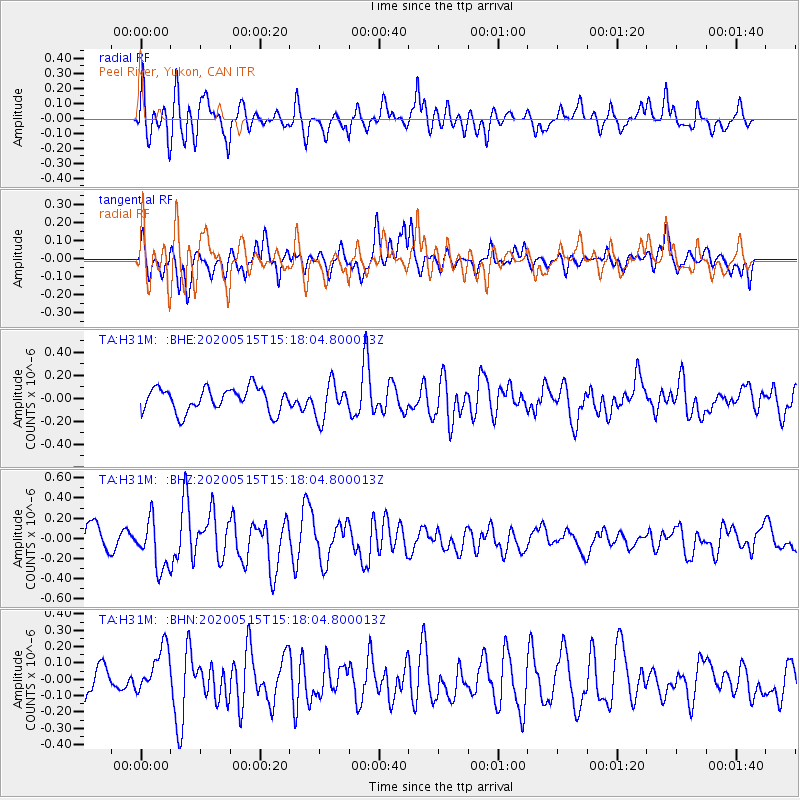
H31M Peel River, Yukon, CAN - Earthquake Result Viewer
*The percent match for this event was below the threshold and hence no stack was calculated.
| Earthquake location: |
Samoa Islands Region |
| Earthquake latitude/longitude: |
-15.8/-172.9 |
| Earthquake time(UTC): |
2020/05/15 (136) 15:05:55 GMT |
| Earthquake Depth: |
19 km |
| Earthquake Magnitude: |
5.6 Mww |
| Earthquake Catalog/Contributor: |
NEIC PDE/us |
|
| Network: |
TA USArray Transportable Network (new EarthScope stations) |
| Station: |
H31M Peel River, Yukon, CAN |
| Lat/Lon: |
65.81 N/134.34 W |
| Elevation: |
642 m |
|
| Distance: |
86.3 deg |
| Az: |
14.913 deg |
| Baz: |
216.953 deg |
| Ray Param: |
$rayparam |
*The percent match for this event was below the threshold and hence was not used in the summary stack. |
|
| Radial Match: |
60.952126 % |
| Radial Bump: |
400 |
| Transverse Match: |
59.056313 % |
| Transverse Bump: |
400 |
| SOD ConfigId: |
21166931 |
| Insert Time: |
2020-06-13 14:30:41.197 +0000 |
| GWidth: |
2.5 |
| Max Bumps: |
400 |
| Tol: |
0.001 |
|
Signal To Noise
| Channel | StoN | STA | LTA |
| TA:H31M: :BHZ:20200515T15:18:04.800013Z | 2.5470495 | 2.4248376E-7 | 9.520182E-8 |
| TA:H31M: :BHN:20200515T15:18:04.800013Z | 1.3034256 | 1.4332274E-7 | 1.0995851E-7 |
| TA:H31M: :BHE:20200515T15:18:04.800013Z | 1.4885849 | 1.5346978E-7 | 1.0309777E-7 |
| Arrivals |
| Ps | |
| PpPs | |
| PsPs/PpSs | |


