You are here: Home > Network List > TA - USArray Transportable Network (new EarthScope stations) Stations List
> Station I30M Mount Dempster, Yukon, CAN > Earthquake Result Viewer
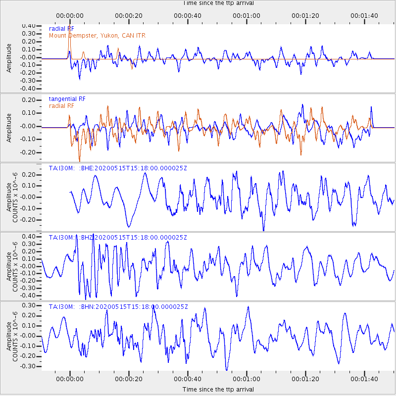
I30M Mount Dempster, Yukon, CAN - Earthquake Result Viewer
*The percent match for this event was below the threshold and hence no stack was calculated.
| Earthquake location: |
Samoa Islands Region |
| Earthquake latitude/longitude: |
-15.8/-172.9 |
| Earthquake time(UTC): |
2020/05/15 (136) 15:05:55 GMT |
| Earthquake Depth: |
19 km |
| Earthquake Magnitude: |
5.6 Mww |
| Earthquake Catalog/Contributor: |
NEIC PDE/us |
|
| Network: |
TA USArray Transportable Network (new EarthScope stations) |
| Station: |
I30M Mount Dempster, Yukon, CAN |
| Lat/Lon: |
65.22 N/136.38 W |
| Elevation: |
1399 m |
|
| Distance: |
85.4 deg |
| Az: |
14.57 deg |
| Baz: |
215.079 deg |
| Ray Param: |
$rayparam |
*The percent match for this event was below the threshold and hence was not used in the summary stack. |
|
| Radial Match: |
52.34196 % |
| Radial Bump: |
400 |
| Transverse Match: |
53.39462 % |
| Transverse Bump: |
400 |
| SOD ConfigId: |
21166931 |
| Insert Time: |
2020-06-13 14:30:44.278 +0000 |
| GWidth: |
2.5 |
| Max Bumps: |
400 |
| Tol: |
0.001 |
|
Signal To Noise
| Channel | StoN | STA | LTA |
| TA:I30M: :BHZ:20200515T15:18:00.000025Z | 1.9400077 | 2.0327992E-7 | 1.04783055E-7 |
| TA:I30M: :BHN:20200515T15:18:00.000025Z | 0.91171974 | 8.5900446E-8 | 9.421804E-8 |
| TA:I30M: :BHE:20200515T15:18:00.000025Z | 1.1092098 | 1.1691853E-7 | 1.0540705E-7 |
| Arrivals |
| Ps | |
| PpPs | |
| PsPs/PpSs | |


