
KZA KN.KZA - Earthquake Result Viewer
| ||||||||||||||||||
| ||||||||||||||||||
| ||||||||||||||||||
|
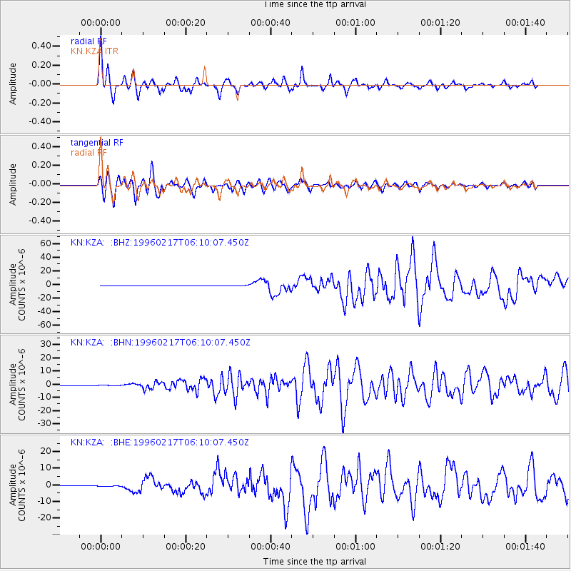
Signal To Noise
| Channel | StoN | STA | LTA |
| KN:KZA: :BHN:19960217T06:10:07.450Z | 2.6010802 | 2.7941303E-7 | 1.0742191E-7 |
| KN:KZA: :BHE:19960217T06:10:07.450Z | 2.6295626 | 3.1352116E-7 | 1.192294E-7 |
| KN:KZA: :BHZ:19960217T06:10:07.450Z | 2.9086974 | 4.2675887E-7 | 1.4671821E-7 |
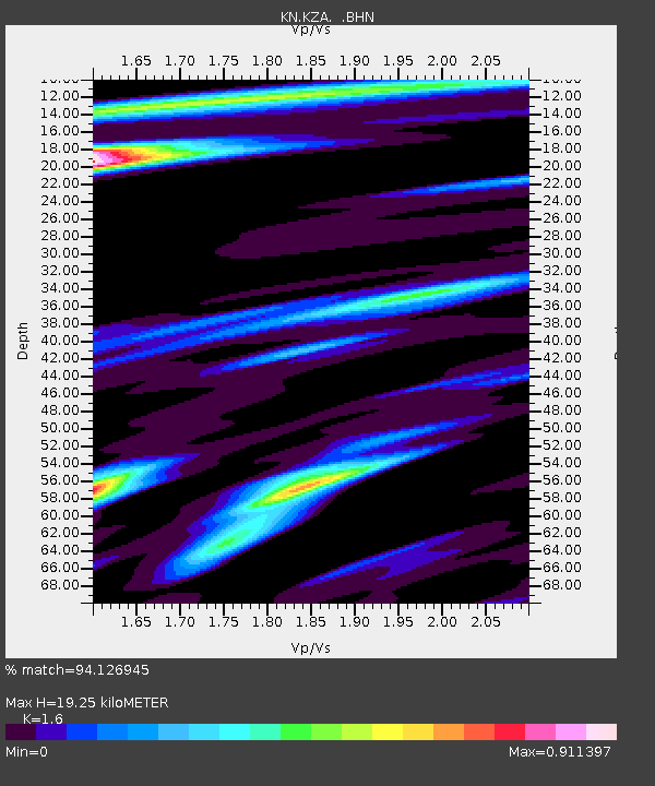
| Arrivals | |
| Ps | 1.9 SECOND |
| PpPs | 7.6 SECOND |
| PsPs/PpSs | 9.5 SECOND |

