KZA KN.KZA - Earthquake Result Viewer
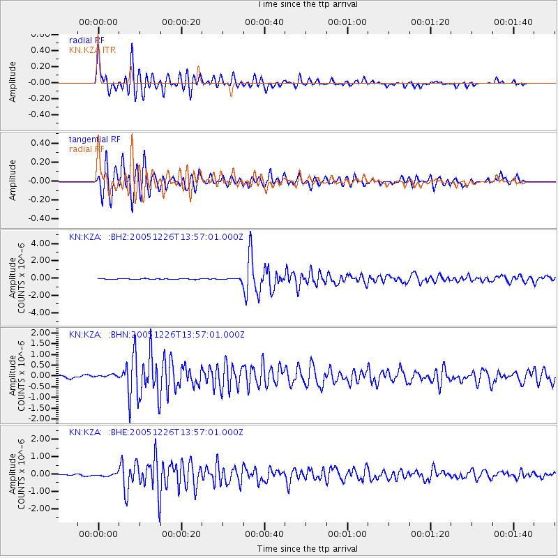
Earthquake location: Bonin Islands, Japan Region
Earthquake latitude/longitude: 26.8/140.6
Earthquake time(UTC): 2005/12/26 (360) 13:48:01 GMT
Earthquake Depth: 7.4 km
Earthquake Magnitude: 5.8 MB, 5.3 MS, 5.7 MW, 5.5 MW
Earthquake Catalog/Contributor: WHDF/NEIC
Network: KN Kyrgyz Seismic Telemetry Network
Station: KZA KN.KZA
Lat/Lon: 42.08 N/75.25 E
Elevation: 3520 m
Distance: 54.8 deg
Az: 304.056 deg
Baz: 83.977 deg
Ray Param: 0.06523348
Estimated Moho Depth: 52.5 km
Estimated Crust Vp/Vs: 1.94
Assumed Crust Vp: 6.306 km/s
Estimated Crust Vs: 3.246 km/s
Estimated Crust Poisson's Ratio: 0.32
Radial Match: 93.01164 %
Radial Bump: 400
Transverse Match: 89.024315 %
Transverse Bump: 400
SOD ConfigId: 2422
Insert Time: 2010-03-08 20:38:45.303 +0000
GWidth: 2.5
Max Bumps: 400
Tol: 0.001

Signal To Noise

ChannelStoNSTALTA
KN:KZA: :BHN:20051226T13:57:01.000Z1.74702361.1289324E-76.462033E-8
KN:KZA: :BHE:20051226T13:57:01.000Z1.59583199.442337E-85.9168745E-8
KN:KZA: :BHZ:20051226T13:57:01.000Z3.95972441.6795188E-74.2415042E-8
Arrivals
Ps8.2 SECOND
PpPs23 SECOND
PsPs/PpSs32 SECOND