KZA KN.KZA - Earthquake Result Viewer
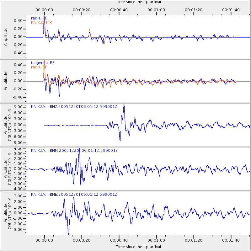
Earthquake location: W. Caroline Islands, Micronesia
Earthquake latitude/longitude: 12.2/141.0
Earthquake time(UTC): 2005/12/20 (354) 05:51:12 GMT
Earthquake Depth: 23 km
Earthquake Magnitude: 5.8 MB, 5.7 MS, 6.1 MW, 6.1 MW
Earthquake Catalog/Contributor: WHDF/NEIC
Network: KN Kyrgyz Seismic Telemetry Network
Station: KZA KN.KZA
Lat/Lon: 42.08 N/75.25 E
Elevation: 3520 m
Distance: 63.9 deg
Az: 310.917 deg
Baz: 97.124 deg
Ray Param: 0.059227996
Estimated Moho Depth: 55.25 km
Estimated Crust Vp/Vs: 1.85
Assumed Crust Vp: 6.306 km/s
Estimated Crust Vs: 3.418 km/s
Estimated Crust Poisson's Ratio: 0.29
Radial Match: 95.19525 %
Radial Bump: 383
Transverse Match: 93.54551 %
Transverse Bump: 400
SOD ConfigId: 2422
Insert Time: 2010-03-08 20:38:50.988 +0000
GWidth: 2.5
Max Bumps: 400
Tol: 0.001

Signal To Noise

ChannelStoNSTALTA
KN:KZA: :BHN:20051220T06:01:12.599001Z1.12137731.0245766E-79.1367696E-8
KN:KZA: :BHE:20051220T06:01:12.599001Z1.88988021.3699503E-77.248873E-8
KN:KZA: :BHZ:20051220T06:01:12.599001Z3.5352764.4131278E-71.2483122E-7
Arrivals
Ps7.7 SECOND
PpPs24 SECOND
PsPs/PpSs32 SECOND