KZA KN.KZA - Earthquake Result Viewer
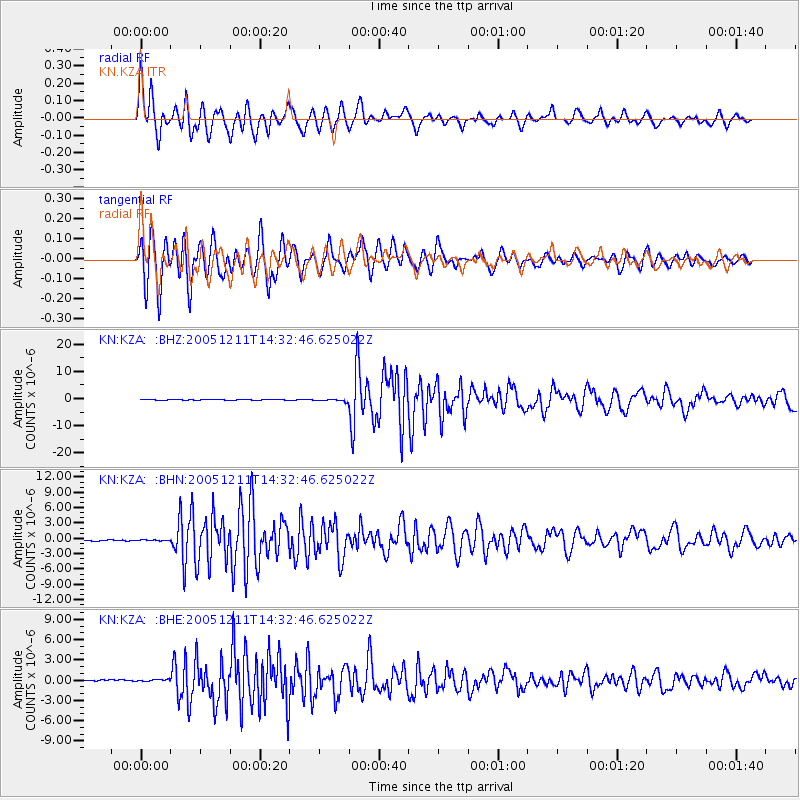
Earthquake location: New Britain Region, P.N.G.
Earthquake latitude/longitude: -6.6/152.2
Earthquake time(UTC): 2005/12/11 (345) 14:20:43 GMT
Earthquake Depth: 10 km
Earthquake Magnitude: 6.2 MB, 6.2 MS, 6.6 MW, 6.5 MW
Earthquake Catalog/Contributor: WHDF/NEIC
Network: KN Kyrgyz Seismic Telemetry Network
Station: KZA KN.KZA
Lat/Lon: 42.08 N/75.25 E
Elevation: 3520 m
Distance: 84.8 deg
Az: 313.259 deg
Baz: 103.616 deg
Ray Param: 0.045246705
Estimated Moho Depth: 19.0 km
Estimated Crust Vp/Vs: 1.60
Assumed Crust Vp: 6.306 km/s
Estimated Crust Vs: 3.941 km/s
Estimated Crust Poisson's Ratio: 0.18
Radial Match: 95.485146 %
Radial Bump: 400
Transverse Match: 95.404625 %
Transverse Bump: 400
SOD ConfigId: 2422
Insert Time: 2010-03-08 20:38:54.405 +0000
GWidth: 2.5
Max Bumps: 400
Tol: 0.001

Signal To Noise

ChannelStoNSTALTA
KN:KZA: :BHN:20051211T14:32:46.625022Z0.65753741.0531951E-71.6017266E-7
KN:KZA: :BHE:20051211T14:32:46.625022Z1.39756141.8203644E-71.302529E-7
KN:KZA: :BHZ:20051211T14:32:46.625022Z6.67067244.1036412E-76.151765E-8
Arrivals
Ps1.9 SECOND
PpPs7.6 SECOND
PsPs/PpSs9.5 SECOND