KZA KN.KZA - Earthquake Result Viewer
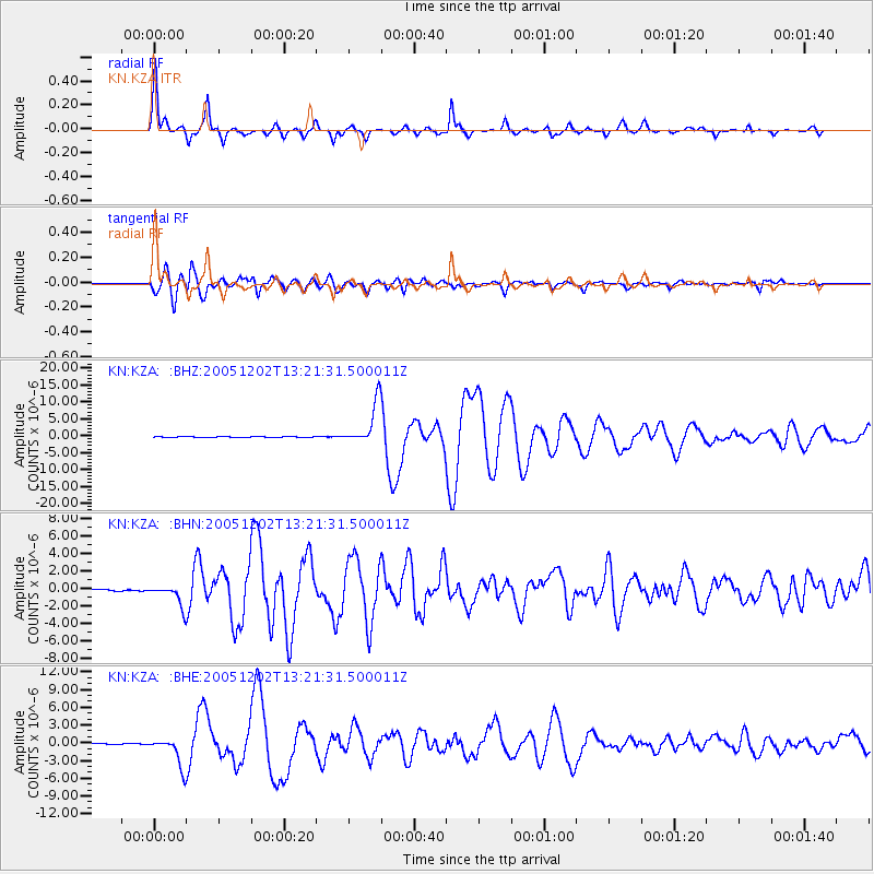
Earthquake location: Near East Coast Of Honshu, Japan
Earthquake latitude/longitude: 38.1/142.1
Earthquake time(UTC): 2005/12/02 (336) 13:13:09 GMT
Earthquake Depth: 29 km
Earthquake Magnitude: 6.1 MB, 6.3 MS, 6.5 MW, 6.4 MW
Earthquake Catalog/Contributor: WHDF/NEIC
Network: KN Kyrgyz Seismic Telemetry Network
Station: KZA KN.KZA
Lat/Lon: 42.08 N/75.25 E
Elevation: 3520 m
Distance: 50.1 deg
Az: 296.89 deg
Baz: 70.961 deg
Ray Param: 0.06820174
Estimated Moho Depth: 57.75 km
Estimated Crust Vp/Vs: 1.84
Assumed Crust Vp: 6.306 km/s
Estimated Crust Vs: 3.423 km/s
Estimated Crust Poisson's Ratio: 0.29
Radial Match: 96.7713 %
Radial Bump: 307
Transverse Match: 95.20144 %
Transverse Bump: 400
SOD ConfigId: 2422
Insert Time: 2010-03-08 20:38:57.677 +0000
GWidth: 2.5
Max Bumps: 400
Tol: 0.001

Signal To Noise

ChannelStoNSTALTA
KN:KZA: :BHN:20051202T13:21:31.500011Z13.2355021.1731605E-68.863741E-8
KN:KZA: :BHE:20051202T13:21:31.500011Z35.091592.4926765E-67.103344E-8
KN:KZA: :BHZ:20051202T13:21:31.500011Z48.667646.154218E-61.2645401E-7
Arrivals
Ps8.1 SECOND
PpPs25 SECOND
PsPs/PpSs33 SECOND