You are here: Home > Network List > AV - Alaska Volcano Observatory Stations List
> Station PLBL Mt. Peulik Volcano, Alaska > Earthquake Result Viewer
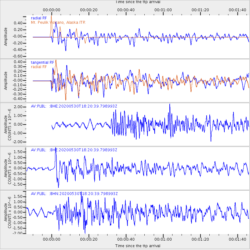
PLBL Mt. Peulik Volcano, Alaska - Earthquake Result Viewer
*The percent match for this event was below the threshold and hence no stack was calculated.
| Earthquake location: |
Hokkaido, Japan Region |
| Earthquake latitude/longitude: |
42.4/143.9 |
| Earthquake time(UTC): |
2020/05/30 (151) 18:13:47 GMT |
| Earthquake Depth: |
94 km |
| Earthquake Magnitude: |
5.6 Mww |
| Earthquake Catalog/Contributor: |
NEIC PDE/us |
|
| Network: |
AV Alaska Volcano Observatory |
| Station: |
PLBL Mt. Peulik Volcano, Alaska |
| Lat/Lon: |
57.70 N/156.82 W |
| Elevation: |
461 m |
|
| Distance: |
39.6 deg |
| Az: |
46.36 deg |
| Baz: |
273.728 deg |
| Ray Param: |
$rayparam |
*The percent match for this event was below the threshold and hence was not used in the summary stack. |
|
| Radial Match: |
63.7752 % |
| Radial Bump: |
400 |
| Transverse Match: |
60.35004 % |
| Transverse Bump: |
400 |
| SOD ConfigId: |
21166931 |
| Insert Time: |
2020-06-13 18:19:08.683 +0000 |
| GWidth: |
2.5 |
| Max Bumps: |
400 |
| Tol: |
0.001 |
|
Signal To Noise
| Channel | StoN | STA | LTA |
| AV:PLBL: :BHZ:20200530T18:20:39.798993Z | 5.459584 | 8.4507974E-7 | 1.5478828E-7 |
| AV:PLBL: :BHN:20200530T18:20:39.798993Z | 2.3688002 | 4.712681E-7 | 1.9894802E-7 |
| AV:PLBL: :BHE:20200530T18:20:39.798993Z | 2.787567 | 6.6723294E-7 | 2.3936033E-7 |
| Arrivals |
| Ps | |
| PpPs | |
| PsPs/PpSs | |


