You are here: Home > Network List > AV - Alaska Volcano Observatory Stations List
> Station SPCR Ckakachatna River, Mount Spurr, Alaska > Earthquake Result Viewer
SPCR Ckakachatna River, Mount Spurr, Alaska - Earthquake Result Viewer
*The percent match for this event was below the threshold and hence no stack was calculated.
| Earthquake location: |
Hokkaido, Japan Region |
| Earthquake latitude/longitude: |
42.4/143.9 |
| Earthquake time(UTC): |
2020/05/30 (151) 18:13:47 GMT |
| Earthquake Depth: |
94 km |
| Earthquake Magnitude: |
5.6 Mww |
| Earthquake Catalog/Contributor: |
NEIC PDE/us |
|
| Network: |
AV Alaska Volcano Observatory |
| Station: |
SPCR Ckakachatna River, Mount Spurr, Alaska |
| Lat/Lon: |
61.20 N/152.21 W |
| Elevation: |
984 m |
|
| Distance: |
41.7 deg |
| Az: |
40.758 deg |
| Baz: |
273.445 deg |
| Ray Param: |
$rayparam |
*The percent match for this event was below the threshold and hence was not used in the summary stack. |
|
| Radial Match: |
79.3058 % |
| Radial Bump: |
400 |
| Transverse Match: |
58.018635 % |
| Transverse Bump: |
400 |
| SOD ConfigId: |
21166931 |
| Insert Time: |
2020-06-13 18:19:27.717 +0000 |
| GWidth: |
2.5 |
| Max Bumps: |
400 |
| Tol: |
0.001 |
|
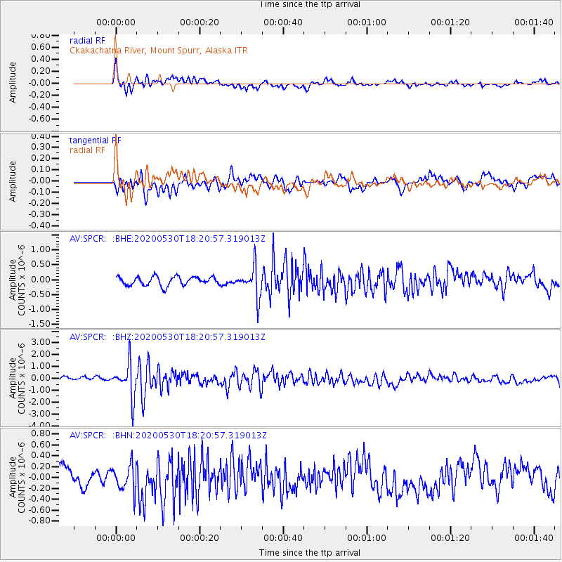
Signal To Noise
| Channel | StoN | STA | LTA |
| AV:SPCR: :BHZ:20200530T18:20:57.319013Z | 7.6508374 | 1.4294276E-6 | 1.8683282E-7 |
| AV:SPCR: :BHN:20200530T18:20:57.319013Z | 1.3456055 | 2.5386436E-7 | 1.8866182E-7 |
| AV:SPCR: :BHE:20200530T18:20:57.319013Z | 3.5746472 | 5.181099E-7 | 1.4494015E-7 |
| Arrivals |
| Ps | |
| PpPs | |
| PsPs/PpSs | |


