KZA KN.KZA - Earthquake Result Viewer
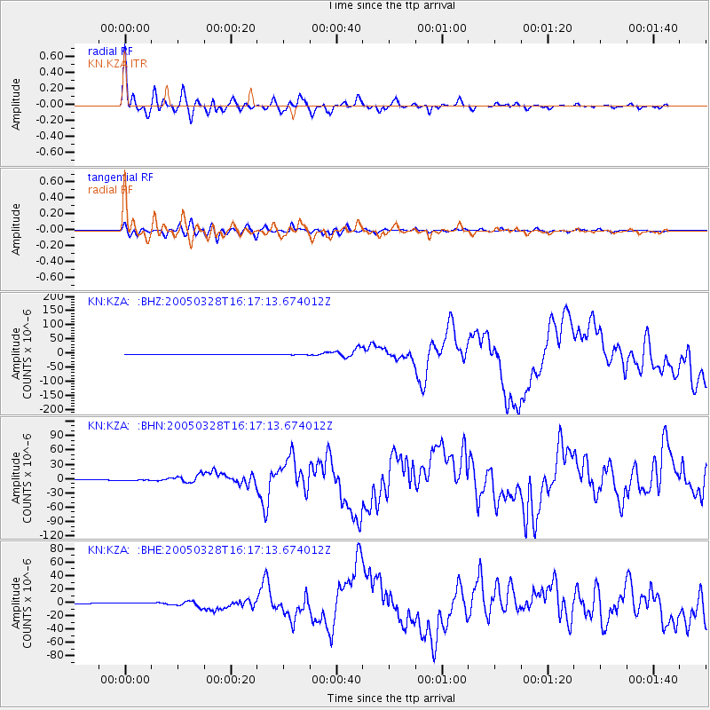
Earthquake location: Northern Sumatra, Indonesia
Earthquake latitude/longitude: 2.1/97.1
Earthquake time(UTC): 2005/03/28 (087) 16:09:36 GMT
Earthquake Depth: 30 km
Earthquake Magnitude: 7.2 MB, 8.4 MS, 8.7 MW, 8.1 MW
Earthquake Catalog/Contributor: WHDF/NEIC
Network: KN Kyrgyz Seismic Telemetry Network
Station: KZA KN.KZA
Lat/Lon: 42.08 N/75.25 E
Elevation: 3520 m
Distance: 44.4 deg
Az: 336.656 deg
Baz: 147.866 deg
Ray Param: 0.07189253
Estimated Moho Depth: 60.75 km
Estimated Crust Vp/Vs: 2.08
Assumed Crust Vp: 6.306 km/s
Estimated Crust Vs: 3.035 km/s
Estimated Crust Poisson's Ratio: 0.35
Radial Match: 93.87 %
Radial Bump: 400
Transverse Match: 89.89706 %
Transverse Bump: 400
SOD ConfigId: 2459
Insert Time: 2010-03-08 20:39:47.108 +0000
GWidth: 2.5
Max Bumps: 400
Tol: 0.001

Signal To Noise

ChannelStoNSTALTA
KN:KZA: :BHN:20050328T16:17:13.674012Z5.5118211.2540628E-62.275224E-7
KN:KZA: :BHE:20050328T16:17:13.674012Z5.04937848.0154274E-71.5874087E-7
KN:KZA: :BHZ:20050328T16:17:13.674012Z5.0586851.970295E-63.8948758E-7
Arrivals
Ps11 SECOND
PpPs28 SECOND
PsPs/PpSs39 SECOND