KZA KN.KZA - Earthquake Result Viewer
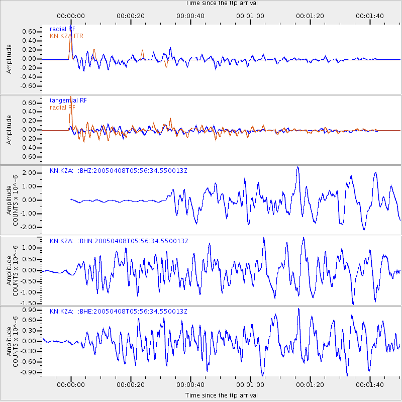
Earthquake location: Southwest Of Sumatra, Indonesia
Earthquake latitude/longitude: -0.2/97.7
Earthquake time(UTC): 2005/04/08 (098) 05:48:37 GMT
Earthquake Depth: 21 km
Earthquake Magnitude: 5.7 MB, 6.3 MS, 6.1 MW, 6.1 MW
Earthquake Catalog/Contributor: WHDF/NEIC
Network: KN Kyrgyz Seismic Telemetry Network
Station: KZA KN.KZA
Lat/Lon: 42.08 N/75.25 E
Elevation: 3520 m
Distance: 46.7 deg
Az: 336.987 deg
Baz: 148.323 deg
Ray Param: 0.07042974
Estimated Moho Depth: 60.0 km
Estimated Crust Vp/Vs: 2.10
Assumed Crust Vp: 6.306 km/s
Estimated Crust Vs: 3.006 km/s
Estimated Crust Poisson's Ratio: 0.35
Radial Match: 94.80717 %
Radial Bump: 400
Transverse Match: 82.61719 %
Transverse Bump: 400
SOD ConfigId: 2459
Insert Time: 2010-03-08 20:39:50.100 +0000
GWidth: 2.5
Max Bumps: 400
Tol: 0.001

Signal To Noise

ChannelStoNSTALTA
KN:KZA: :BHN:20050408T05:56:34.550013Z3.0676182.0960061E-76.8326834E-8
KN:KZA: :BHE:20050408T05:56:34.550013Z1.02488126.141895E-85.992788E-8
KN:KZA: :BHZ:20050408T05:56:34.550013Z6.48153453.5389925E-75.4601156E-8
Arrivals
Ps11 SECOND
PpPs28 SECOND
PsPs/PpSs39 SECOND