You are here: Home > Network List > CI - Caltech Regional Seismic Network Stations List
> Station MPM Manuel Prospect Mine, California, USA > Earthquake Result Viewer
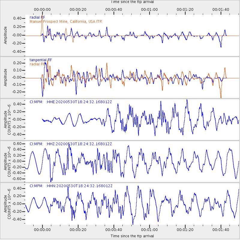
MPM Manuel Prospect Mine, California, USA - Earthquake Result Viewer
*The percent match for this event was below the threshold and hence no stack was calculated.
| Earthquake location: |
Hokkaido, Japan Region |
| Earthquake latitude/longitude: |
42.4/143.9 |
| Earthquake time(UTC): |
2020/05/30 (151) 18:13:47 GMT |
| Earthquake Depth: |
94 km |
| Earthquake Magnitude: |
5.6 Mww |
| Earthquake Catalog/Contributor: |
NEIC PDE/us |
|
| Network: |
CI Caltech Regional Seismic Network |
| Station: |
MPM Manuel Prospect Mine, California, USA |
| Lat/Lon: |
36.06 N/117.49 W |
| Elevation: |
185 m |
|
| Distance: |
72.3 deg |
| Az: |
57.268 deg |
| Baz: |
309.771 deg |
| Ray Param: |
$rayparam |
*The percent match for this event was below the threshold and hence was not used in the summary stack. |
|
| Radial Match: |
65.37798 % |
| Radial Bump: |
400 |
| Transverse Match: |
74.67372 % |
| Transverse Bump: |
400 |
| SOD ConfigId: |
21166931 |
| Insert Time: |
2020-06-13 18:22:15.479 +0000 |
| GWidth: |
2.5 |
| Max Bumps: |
400 |
| Tol: |
0.001 |
|
Signal To Noise
| Channel | StoN | STA | LTA |
| CI:MPM: :HHZ:20200530T18:24:32.168012Z | 1.7919794 | 3.229124E-7 | 1.8019873E-7 |
| CI:MPM: :HHN:20200530T18:24:32.168012Z | 1.3928294 | 1.15389774E-7 | 8.284559E-8 |
| CI:MPM: :HHE:20200530T18:24:32.168012Z | 0.67980486 | 5.65716E-8 | 8.321741E-8 |
| Arrivals |
| Ps | |
| PpPs | |
| PsPs/PpSs | |


