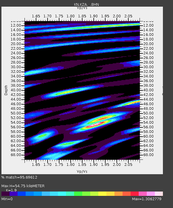
KZA KN.KZA - Earthquake Result Viewer
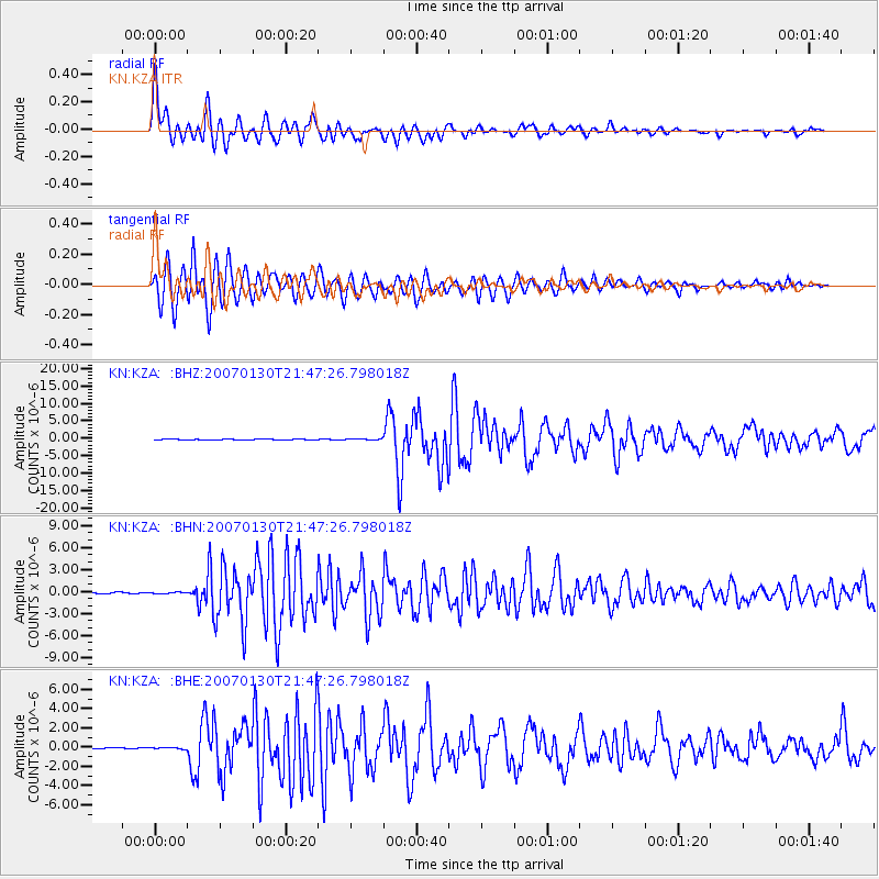
Earthquake location: Mariana Islands
Earthquake latitude/longitude: 21.0/144.7
Earthquake time(UTC): 2007/01/30 (030) 21:37:45 GMT
Earthquake Depth: 30 km
Earthquake Magnitude: 6.3 MB, 6.5 MS, 6.6 MW, 6.5 MW
Earthquake Catalog/Contributor: WHDF/NEIC
Network: KN Kyrgyz Seismic Telemetry Network
Station: KZA KN.KZA
Lat/Lon: 42.08 N/75.25 E
Elevation: 3520 m
Distance: 61.2 deg
Az: 307.291 deg
Baz: 86.99 deg
Ray Param: 0.06098862
Estimated Moho Depth: 54.75 km
Estimated Crust Vp/Vs: 1.90
Assumed Crust Vp: 6.306 km/s
Estimated Crust Vs: 3.319 km/s
Estimated Crust Poisson's Ratio: 0.31
Radial Match: 95.69612 %
Radial Bump: 400
Transverse Match: 91.89163 %
Transverse Bump: 400
SOD ConfigId: 2564
Insert Time: 2010-03-08 20:40:32.018 +0000
GWidth: 2.5
Max Bumps: 400
Tol: 0.001

Signal To Noise

ChannelStoNSTALTA
KN:KZA: :BHN:20070130T21:47:26.798018Z0.89446341.4846825E-71.6598582E-7
KN:KZA: :BHE:20070130T21:47:26.798018Z1.30358279.141156E-87.0123335E-8
KN:KZA: :BHZ:20070130T21:47:26.798018Z1.28670931.3282792E-71.0323072E-7
Arrivals
Ps8.1 SECOND
PpPs24 SECOND
PsPs/PpSs32 SECOND