KZA KN.KZA - Earthquake Result Viewer
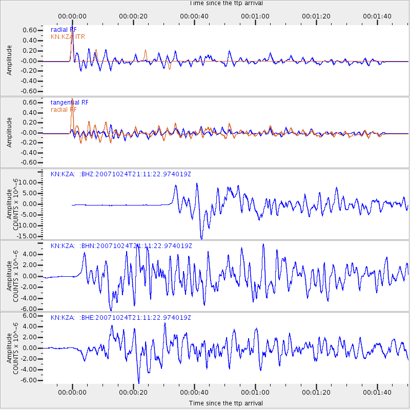
Earthquake location: Southern Sumatra, Indonesia
Earthquake latitude/longitude: -3.9/101.0
Earthquake time(UTC): 2007/10/24 (297) 21:02:50 GMT
Earthquake Depth: 20 km
Earthquake Magnitude: 6.1 MB, 6.9 MS, 6.8 MW, 6.3 ME
Earthquake Catalog/Contributor: WHDF/NEIC
Network: KN Kyrgyz Seismic Telemetry Network
Station: KZA KN.KZA
Lat/Lon: 42.08 N/75.25 E
Elevation: 3520 m
Distance: 51.4 deg
Az: 335.537 deg
Baz: 146.292 deg
Ray Param: 0.06741322
Estimated Moho Depth: 19.25 km
Estimated Crust Vp/Vs: 1.60
Assumed Crust Vp: 6.306 km/s
Estimated Crust Vs: 3.941 km/s
Estimated Crust Poisson's Ratio: 0.18
Radial Match: 93.53864 %
Radial Bump: 400
Transverse Match: 86.726776 %
Transverse Bump: 400
SOD ConfigId: 2564
Insert Time: 2010-03-08 20:40:49.550 +0000
GWidth: 2.5
Max Bumps: 400
Tol: 0.001

Signal To Noise

ChannelStoNSTALTA
KN:KZA: :BHN:20071024T21:11:22.974019Z6.9323771.8154287E-62.618768E-7
KN:KZA: :BHE:20071024T21:11:22.974019Z8.4558849.178987E-71.08551475E-7
KN:KZA: :BHZ:20071024T21:11:22.974019Z41.7024573.511905E-68.421339E-8
Arrivals
Ps1.9 SECOND
PpPs7.5 SECOND
PsPs/PpSs9.4 SECOND