
KZA KN.KZA - Earthquake Result Viewer
| ||||||||||||||||||
| ||||||||||||||||||
| ||||||||||||||||||
|
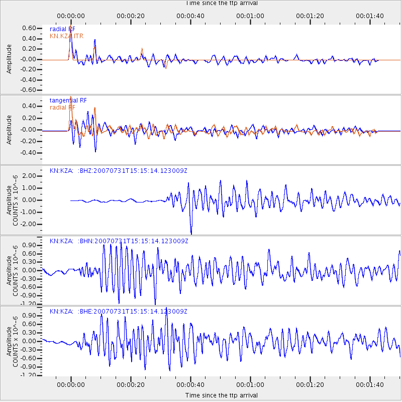
Signal To Noise
| Channel | StoN | STA | LTA |
| KN:KZA: :BHN:20070731T15:15:14.123009Z | 1.6635408 | 9.630474E-8 | 5.7891416E-8 |
| KN:KZA: :BHE:20070731T15:15:14.123009Z | 3.6026459 | 1.3599576E-7 | 3.7748855E-8 |
| KN:KZA: :BHZ:20070731T15:15:14.123009Z | 3.7125506 | 2.5927352E-7 | 6.9837036E-8 |
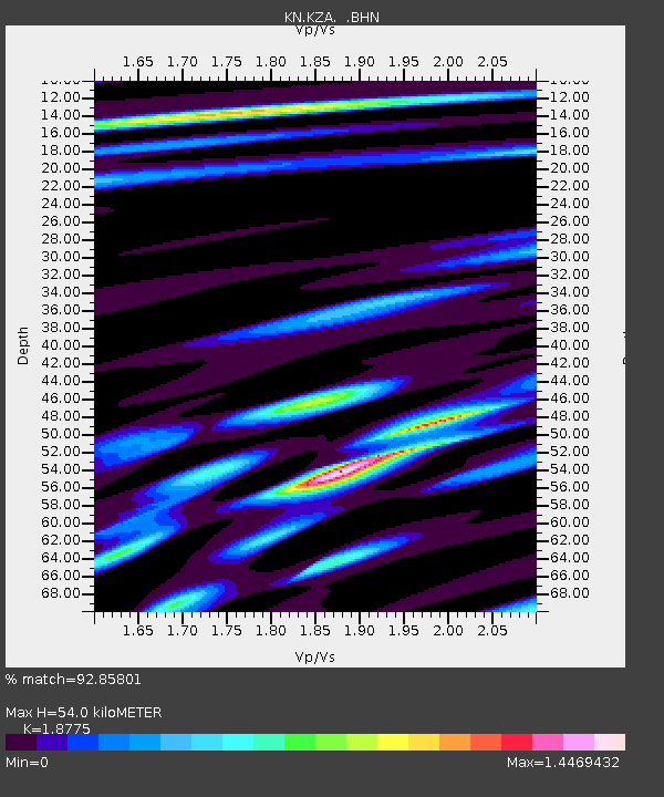
| Arrivals | |
| Ps | 8.0 SECOND |
| PpPs | 23 SECOND |
| PsPs/PpSs | 31 SECOND |

