KZA KN.KZA - Earthquake Result Viewer
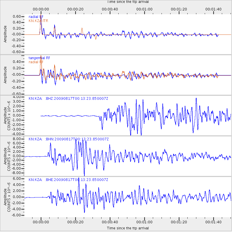
Earthquake location: Southwestern Ryukyu Isl., Japan
Earthquake latitude/longitude: 23.5/123.5
Earthquake time(UTC): 2009/08/17 (229) 00:05:49 GMT
Earthquake Depth: 20 km
Earthquake Magnitude: 6.2 MB, 6.6 MS, 6.7 MW, 6.6 MW
Earthquake Catalog/Contributor: WHDF/NEIC
Network: KN Kyrgyz Seismic Telemetry Network
Station: KZA KN.KZA
Lat/Lon: 42.08 N/75.25 E
Elevation: 3520 m
Distance: 44.0 deg
Az: 306.857 deg
Baz: 99.364 deg
Ray Param: 0.07218562
Estimated Moho Depth: 52.75 km
Estimated Crust Vp/Vs: 1.90
Assumed Crust Vp: 6.306 km/s
Estimated Crust Vs: 3.315 km/s
Estimated Crust Poisson's Ratio: 0.31
Radial Match: 94.97547 %
Radial Bump: 400
Transverse Match: 93.54249 %
Transverse Bump: 400
SOD ConfigId: 2622
Insert Time: 2010-03-08 20:41:25.551 +0000
GWidth: 2.5
Max Bumps: 400
Tol: 0.001

Signal To Noise

ChannelStoNSTALTA
KN:KZA: :BHN:20090817T00:13:23.850007Z8.68510155.5470105E-76.3868114E-8
KN:KZA: :BHE:20090817T00:13:23.850007Z2.40525442.139319E-78.8943565E-8
KN:KZA: :BHZ:20090817T00:13:23.850007Z4.97689152.8939886E-75.814852E-8
Arrivals
Ps8.0 SECOND
PpPs23 SECOND
PsPs/PpSs31 SECOND