KZA KN.KZA - Earthquake Result Viewer
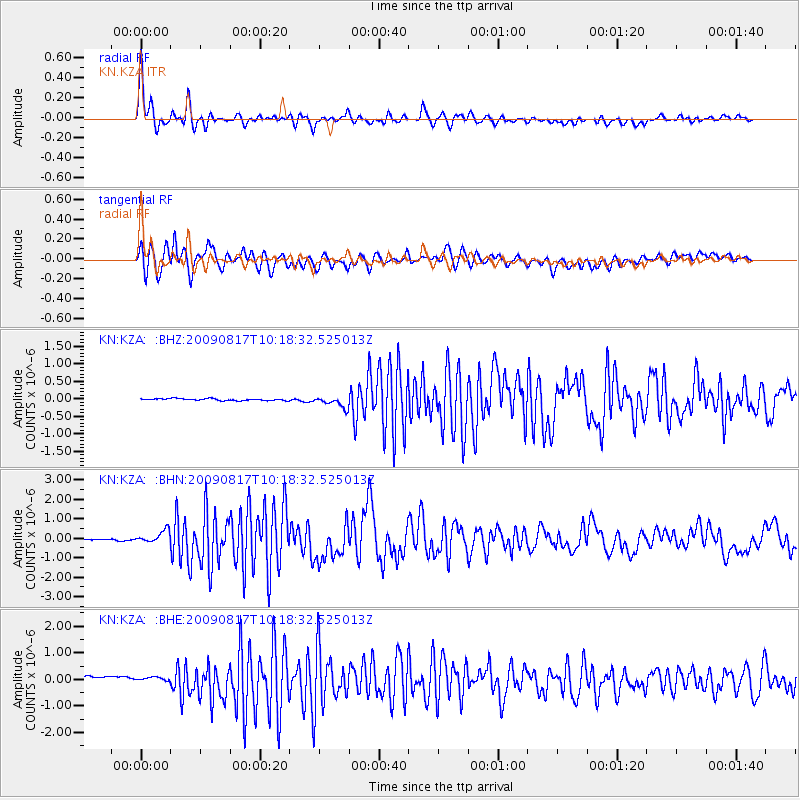
Earthquake location: Southwestern Ryukyu Isl., Japan
Earthquake latitude/longitude: 23.4/123.5
Earthquake time(UTC): 2009/08/17 (229) 10:10:55 GMT
Earthquake Depth: 10 km
Earthquake Magnitude: 5.9 MB, 6.2 MS, 6.1 MW, 6.1 MW
Earthquake Catalog/Contributor: WHDF/NEIC
Network: KN Kyrgyz Seismic Telemetry Network
Station: KZA KN.KZA
Lat/Lon: 42.08 N/75.25 E
Elevation: 3520 m
Distance: 44.0 deg
Az: 306.915 deg
Baz: 99.43 deg
Ray Param: 0.07216985
Estimated Moho Depth: 46.5 km
Estimated Crust Vp/Vs: 2.02
Assumed Crust Vp: 6.306 km/s
Estimated Crust Vs: 3.122 km/s
Estimated Crust Poisson's Ratio: 0.34
Radial Match: 95.29813 %
Radial Bump: 400
Transverse Match: 90.79145 %
Transverse Bump: 400
SOD ConfigId: 2622
Insert Time: 2010-03-08 20:41:27.494 +0000
GWidth: 2.5
Max Bumps: 400
Tol: 0.001

Signal To Noise

ChannelStoNSTALTA
KN:KZA: :BHN:20090817T10:18:32.525013Z5.8595793.2441613E-75.536509E-8
KN:KZA: :BHE:20090817T10:18:32.525013Z0.890657378.8110916E-89.8927956E-8
KN:KZA: :BHZ:20090817T10:18:32.525013Z6.08441731.6072782E-72.6416306E-8
Arrivals
Ps7.9 SECOND
PpPs21 SECOND
PsPs/PpSs29 SECOND