You are here: Home > Network List > KN - Kyrgyz Seismic Telemetry Network Stations List
> Station KZA KN.KZA > Earthquake Result Viewer
KZA KN.KZA - Earthquake Result Viewer

| Earthquake location: |
Mindanao, Philippines |
| Earthquake latitude/longitude: |
6.7/123.4 |
| Earthquake time(UTC): |
2009/10/04 (277) 10:58:00 GMT |
| Earthquake Depth: |
620 km |
| Earthquake Magnitude: |
6.4 MB, 6.6 MW, 6.6 MW |
| Earthquake Catalog/Contributor: |
WHDF/NEIC |
|
| Network: |
KN Kyrgyz Seismic Telemetry Network |
| Station: |
KZA KN.KZA |
| Lat/Lon: |
42.08 N/75.25 E |
| Elevation: |
3520 m |
|
| Distance: |
55.2 deg |
| Az: |
317.509 deg |
| Baz: |
115.692 deg |
| Ray Param: |
0.062265962 |
| Estimated Moho Depth: |
18.75 km |
| Estimated Crust Vp/Vs: |
1.60 |
| Assumed Crust Vp: |
6.306 km/s |
| Estimated Crust Vs: |
3.941 km/s |
| Estimated Crust Poisson's Ratio: |
0.18 |
|
| Radial Match: |
93.67456 % |
| Radial Bump: |
318 |
| Transverse Match: |
88.89481 % |
| Transverse Bump: |
400 |
| SOD ConfigId: |
2622 |
| Insert Time: |
2010-03-08 20:41:42.556 +0000 |
| GWidth: |
2.5 |
| Max Bumps: |
400 |
| Tol: |
0.001 |
|
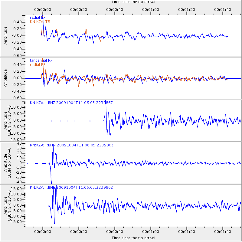
Signal To Noise
| Channel | StoN | STA | LTA |
| KN:KZA: :BHN:20091004T11:06:05.223986Z | 91.0632 | 9.283622E-6 | 1.01947016E-7 |
| KN:KZA: :BHE:20091004T11:06:05.223986Z | 32.980625 | 2.3556959E-6 | 7.142666E-8 |
| KN:KZA: :BHZ:20091004T11:06:05.223986Z | 32.533314 | 2.8967972E-6 | 8.904095E-8 |
| Arrivals |
| Ps | 1.9 SECOND |
| PpPs | 7.3 SECOND |
| PsPs/PpSs | 9.2 SECOND |


