You are here: Home > Network List > TA - USArray Transportable Network (new EarthScope stations) Stations List
> Station F21K Alatna River, AK, USA > Earthquake Result Viewer
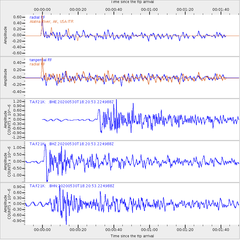
F21K Alatna River, AK, USA - Earthquake Result Viewer
*The percent match for this event was below the threshold and hence no stack was calculated.
| Earthquake location: |
Hokkaido, Japan Region |
| Earthquake latitude/longitude: |
42.4/143.9 |
| Earthquake time(UTC): |
2020/05/30 (151) 18:13:47 GMT |
| Earthquake Depth: |
94 km |
| Earthquake Magnitude: |
5.6 Mww |
| Earthquake Catalog/Contributor: |
NEIC PDE/us |
|
| Network: |
TA USArray Transportable Network (new EarthScope stations) |
| Station: |
F21K Alatna River, AK, USA |
| Lat/Lon: |
67.22 N/153.48 W |
| Elevation: |
597 m |
|
| Distance: |
41.2 deg |
| Az: |
31.618 deg |
| Baz: |
265.445 deg |
| Ray Param: |
$rayparam |
*The percent match for this event was below the threshold and hence was not used in the summary stack. |
|
| Radial Match: |
65.89054 % |
| Radial Bump: |
400 |
| Transverse Match: |
51.680553 % |
| Transverse Bump: |
400 |
| SOD ConfigId: |
21166931 |
| Insert Time: |
2020-06-13 18:38:01.806 +0000 |
| GWidth: |
2.5 |
| Max Bumps: |
400 |
| Tol: |
0.001 |
|
Signal To Noise
| Channel | StoN | STA | LTA |
| TA:F21K: :BHZ:20200530T18:20:53.224988Z | 15.1371155 | 7.468153E-7 | 4.9336695E-8 |
| TA:F21K: :BHN:20200530T18:20:53.224988Z | 1.514825 | 1.015659E-7 | 6.704795E-8 |
| TA:F21K: :BHE:20200530T18:20:53.224988Z | 12.792161 | 4.4883276E-7 | 3.5086547E-8 |
| Arrivals |
| Ps | |
| PpPs | |
| PsPs/PpSs | |


