You are here: Home > Network List > TA - USArray Transportable Network (new EarthScope stations) Stations List
> Station L15K Ungalak Mountain, AK, USA > Earthquake Result Viewer
L15K Ungalak Mountain, AK, USA - Earthquake Result Viewer
*The percent match for this event was below the threshold and hence no stack was calculated.
| Earthquake location: |
Hokkaido, Japan Region |
| Earthquake latitude/longitude: |
42.4/143.9 |
| Earthquake time(UTC): |
2020/05/30 (151) 18:13:47 GMT |
| Earthquake Depth: |
94 km |
| Earthquake Magnitude: |
5.6 Mww |
| Earthquake Catalog/Contributor: |
NEIC PDE/us |
|
| Network: |
TA USArray Transportable Network (new EarthScope stations) |
| Station: |
L15K Ungalak Mountain, AK, USA |
| Lat/Lon: |
61.68 N/161.49 W |
| Elevation: |
219 m |
|
| Distance: |
37.3 deg |
| Az: |
39.89 deg |
| Baz: |
264.634 deg |
| Ray Param: |
$rayparam |
*The percent match for this event was below the threshold and hence was not used in the summary stack. |
|
| Radial Match: |
69.57134 % |
| Radial Bump: |
400 |
| Transverse Match: |
51.570557 % |
| Transverse Bump: |
400 |
| SOD ConfigId: |
21166931 |
| Insert Time: |
2020-06-13 18:39:02.424 +0000 |
| GWidth: |
2.5 |
| Max Bumps: |
400 |
| Tol: |
0.001 |
|
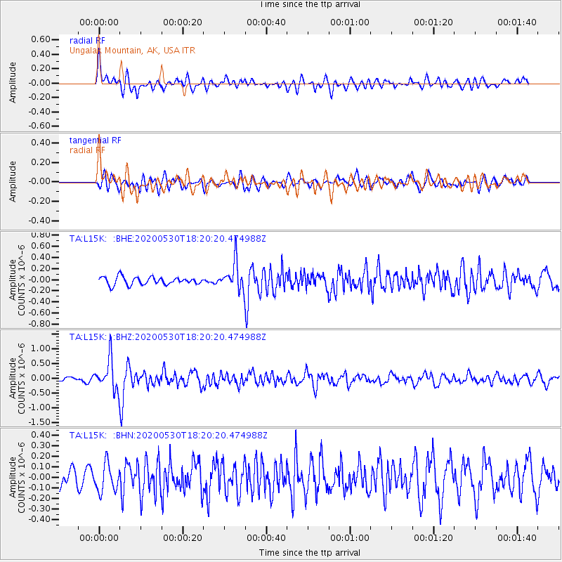
Signal To Noise
| Channel | StoN | STA | LTA |
| TA:L15K: :BHZ:20200530T18:20:20.474988Z | 8.409489 | 5.5512214E-7 | 6.60114E-8 |
| TA:L15K: :BHN:20200530T18:20:20.474988Z | 1.5794845 | 1.3407463E-7 | 8.488505E-8 |
| TA:L15K: :BHE:20200530T18:20:20.474988Z | 3.7917898 | 2.6303306E-7 | 6.936911E-8 |
| Arrivals |
| Ps | |
| PpPs | |
| PsPs/PpSs | |


