You are here: Home > Network List > TA - USArray Transportable Network (new EarthScope stations) Stations List
> Station M16K Timber Creek, AK, USA > Earthquake Result Viewer
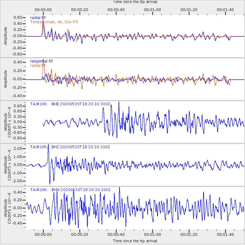
M16K Timber Creek, AK, USA - Earthquake Result Viewer
*The percent match for this event was below the threshold and hence no stack was calculated.
| Earthquake location: |
Hokkaido, Japan Region |
| Earthquake latitude/longitude: |
42.4/143.9 |
| Earthquake time(UTC): |
2020/05/30 (151) 18:13:47 GMT |
| Earthquake Depth: |
94 km |
| Earthquake Magnitude: |
5.6 Mww |
| Earthquake Catalog/Contributor: |
NEIC PDE/us |
|
| Network: |
TA USArray Transportable Network (new EarthScope stations) |
| Station: |
M16K Timber Creek, AK, USA |
| Lat/Lon: |
61.02 N/158.96 W |
| Elevation: |
394 m |
|
| Distance: |
38.5 deg |
| Az: |
41.09 deg |
| Baz: |
267.796 deg |
| Ray Param: |
$rayparam |
*The percent match for this event was below the threshold and hence was not used in the summary stack. |
|
| Radial Match: |
78.310234 % |
| Radial Bump: |
400 |
| Transverse Match: |
63.17581 % |
| Transverse Bump: |
400 |
| SOD ConfigId: |
21166931 |
| Insert Time: |
2020-06-13 18:39:13.585 +0000 |
| GWidth: |
2.5 |
| Max Bumps: |
400 |
| Tol: |
0.001 |
|
Signal To Noise
| Channel | StoN | STA | LTA |
| TA:M16K: :BHZ:20200530T18:20:30.300Z | 10.766586 | 9.90387E-7 | 9.198709E-8 |
| TA:M16K: :BHN:20200530T18:20:30.300Z | 1.5235529 | 1.7395921E-7 | 1.14179954E-7 |
| TA:M16K: :BHE:20200530T18:20:30.300Z | 2.8186152 | 3.3099855E-7 | 1.1743304E-7 |
| Arrivals |
| Ps | |
| PpPs | |
| PsPs/PpSs | |


