You are here: Home > Network List > TA - USArray Transportable Network (new EarthScope stations) Stations List
> Station M31M Drury Creek, Yukon, CA > Earthquake Result Viewer
M31M Drury Creek, Yukon, CA - Earthquake Result Viewer
*The percent match for this event was below the threshold and hence no stack was calculated.
| Earthquake location: |
Hokkaido, Japan Region |
| Earthquake latitude/longitude: |
42.4/143.9 |
| Earthquake time(UTC): |
2020/05/30 (151) 18:13:47 GMT |
| Earthquake Depth: |
94 km |
| Earthquake Magnitude: |
5.6 Mww |
| Earthquake Catalog/Contributor: |
NEIC PDE/us |
|
| Network: |
TA USArray Transportable Network (new EarthScope stations) |
| Station: |
M31M Drury Creek, Yukon, CA |
| Lat/Lon: |
62.20 N/134.39 W |
| Elevation: |
639 m |
|
| Distance: |
49.9 deg |
| Az: |
37.327 deg |
| Baz: |
286.742 deg |
| Ray Param: |
$rayparam |
*The percent match for this event was below the threshold and hence was not used in the summary stack. |
|
| Radial Match: |
77.227776 % |
| Radial Bump: |
400 |
| Transverse Match: |
65.8814 % |
| Transverse Bump: |
400 |
| SOD ConfigId: |
21166931 |
| Insert Time: |
2020-06-13 18:39:21.754 +0000 |
| GWidth: |
2.5 |
| Max Bumps: |
400 |
| Tol: |
0.001 |
|
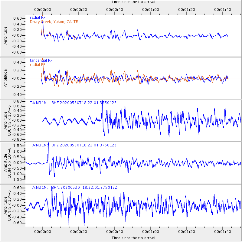
Signal To Noise
| Channel | StoN | STA | LTA |
| TA:M31M: :BHZ:20200530T18:22:01.375012Z | 8.994724 | 6.127866E-7 | 6.812734E-8 |
| TA:M31M: :BHN:20200530T18:22:01.375012Z | 2.7693 | 2.0778518E-7 | 7.503166E-8 |
| TA:M31M: :BHE:20200530T18:22:01.375012Z | 3.572124 | 3.171561E-7 | 8.8786415E-8 |
| Arrivals |
| Ps | |
| PpPs | |
| PsPs/PpSs | |


