You are here: Home > Network List > US - United States National Seismic Network Stations List
> Station EGMT Eagleton, Montana, USA > Earthquake Result Viewer
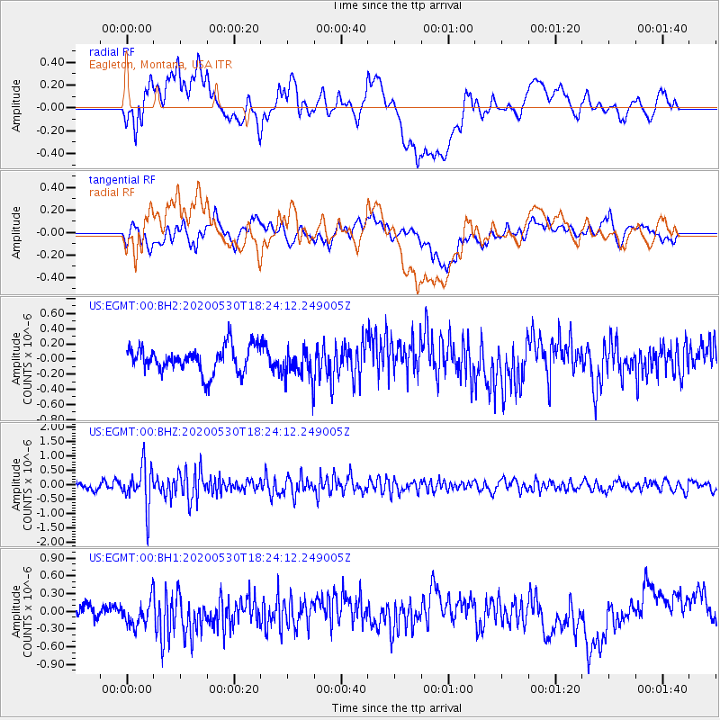
EGMT Eagleton, Montana, USA - Earthquake Result Viewer
*The percent match for this event was below the threshold and hence no stack was calculated.
| Earthquake location: |
Hokkaido, Japan Region |
| Earthquake latitude/longitude: |
42.4/143.9 |
| Earthquake time(UTC): |
2020/05/30 (151) 18:13:47 GMT |
| Earthquake Depth: |
94 km |
| Earthquake Magnitude: |
5.6 Mww |
| Earthquake Catalog/Contributor: |
NEIC PDE/us |
|
| Network: |
US United States National Seismic Network |
| Station: |
EGMT Eagleton, Montana, USA |
| Lat/Lon: |
48.02 N/109.75 W |
| Elevation: |
1055 m |
|
| Distance: |
69.0 deg |
| Az: |
43.649 deg |
| Baz: |
310.425 deg |
| Ray Param: |
$rayparam |
*The percent match for this event was below the threshold and hence was not used in the summary stack. |
|
| Radial Match: |
57.617245 % |
| Radial Bump: |
400 |
| Transverse Match: |
53.193264 % |
| Transverse Bump: |
400 |
| SOD ConfigId: |
21166931 |
| Insert Time: |
2020-06-13 18:42:01.740 +0000 |
| GWidth: |
2.5 |
| Max Bumps: |
400 |
| Tol: |
0.001 |
|
Signal To Noise
| Channel | StoN | STA | LTA |
| US:EGMT:00:BHZ:20200530T18:24:12.249005Z | 6.5868692 | 7.179406E-7 | 1.0899573E-7 |
| US:EGMT:00:BH1:20200530T18:24:12.249005Z | 1.3434799 | 2.3487388E-7 | 1.74825E-7 |
| US:EGMT:00:BH2:20200530T18:24:12.249005Z | 1.2165242 | 2.0536856E-7 | 1.6881584E-7 |
| Arrivals |
| Ps | |
| PpPs | |
| PsPs/PpSs | |


