You are here: Home > Network List > US - United States National Seismic Network Stations List
> Station HAWA Hanford, Washington, USA > Earthquake Result Viewer
HAWA Hanford, Washington, USA - Earthquake Result Viewer
*The percent match for this event was below the threshold and hence no stack was calculated.
| Earthquake location: |
Northern Chile |
| Earthquake latitude/longitude: |
-22.9/-68.6 |
| Earthquake time(UTC): |
2017/06/06 (157) 17:35:08 GMT |
| Earthquake Depth: |
97 km |
| Earthquake Magnitude: |
5.3 Mww |
| Earthquake Catalog/Contributor: |
NEIC PDE/us |
|
| Network: |
US United States National Seismic Network |
| Station: |
HAWA Hanford, Washington, USA |
| Lat/Lon: |
46.39 N/119.53 W |
| Elevation: |
364 m |
|
| Distance: |
82.9 deg |
| Az: |
327.224 deg |
| Baz: |
133.847 deg |
| Ray Param: |
$rayparam |
*The percent match for this event was below the threshold and hence was not used in the summary stack. |
|
| Radial Match: |
58.601578 % |
| Radial Bump: |
400 |
| Transverse Match: |
60.050983 % |
| Transverse Bump: |
400 |
| SOD ConfigId: |
2140511 |
| Insert Time: |
2017-06-20 09:30:28.839 +0000 |
| GWidth: |
2.5 |
| Max Bumps: |
400 |
| Tol: |
0.001 |
|
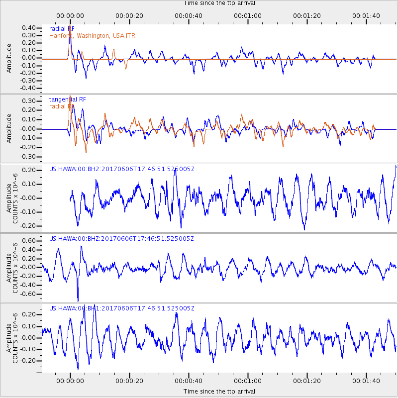
Signal To Noise
| Channel | StoN | STA | LTA |
| US:HAWA:00:BHZ:20170606T17:46:51.525005Z | 2.071937 | 2.6699658E-7 | 1.2886326E-7 |
| US:HAWA:00:BH1:20170606T17:46:51.525005Z | 1.7105601 | 1.5226155E-7 | 8.901269E-8 |
| US:HAWA:00:BH2:20170606T17:46:51.525005Z | 1.3059862 | 8.45922E-8 | 6.4772664E-8 |
| Arrivals |
| Ps | |
| PpPs | |
| PsPs/PpSs | |


