You are here: Home > Network List > NE - New England Seismic Network Stations List
> Station EMMW Machias, ME, USA > Earthquake Result Viewer
EMMW Machias, ME, USA - Earthquake Result Viewer
*The percent match for this event was below the threshold and hence no stack was calculated.
| Earthquake location: |
Southern Peru |
| Earthquake latitude/longitude: |
-15.3/-70.7 |
| Earthquake time(UTC): |
2020/05/31 (152) 05:09:35 GMT |
| Earthquake Depth: |
153 km |
| Earthquake Magnitude: |
6.0 mww |
| Earthquake Catalog/Contributor: |
NEIC PDE/us |
|
| Network: |
NE New England Seismic Network |
| Station: |
EMMW Machias, ME, USA |
| Lat/Lon: |
44.71 N/67.46 W |
| Elevation: |
35 m |
|
| Distance: |
59.8 deg |
| Az: |
2.645 deg |
| Baz: |
183.582 deg |
| Ray Param: |
$rayparam |
*The percent match for this event was below the threshold and hence was not used in the summary stack. |
|
| Radial Match: |
77.07979 % |
| Radial Bump: |
400 |
| Transverse Match: |
63.006687 % |
| Transverse Bump: |
400 |
| SOD ConfigId: |
21166931 |
| Insert Time: |
2020-06-14 05:26:04.753 +0000 |
| GWidth: |
2.5 |
| Max Bumps: |
400 |
| Tol: |
0.001 |
|
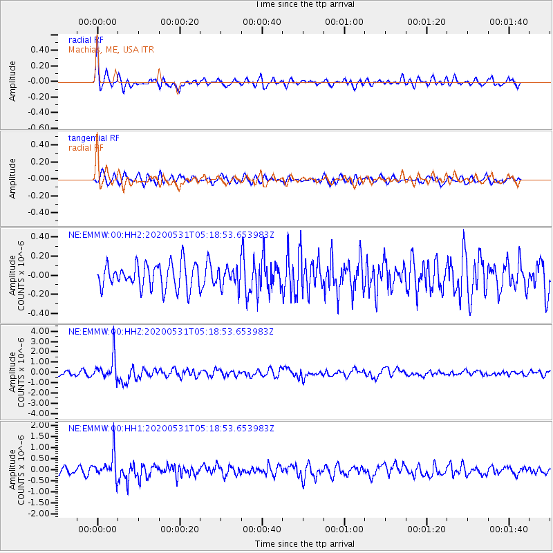
Signal To Noise
| Channel | StoN | STA | LTA |
| NE:EMMW:00:HHZ:20200531T05:18:53.653983Z | 5.225924 | 1.1933793E-6 | 2.2835755E-7 |
| NE:EMMW:00:HH1:20200531T05:18:53.653983Z | 3.9345403 | 5.7215937E-7 | 1.4541962E-7 |
| NE:EMMW:00:HH2:20200531T05:18:53.653983Z | 0.830672 | 1.0712821E-7 | 1.2896572E-7 |
| Arrivals |
| Ps | |
| PpPs | |
| PsPs/PpSs | |


