You are here: Home > Network List > TA - USArray Transportable Network (new EarthScope stations) Stations List
> Station I30M Mount Dempster, Yukon, CAN > Earthquake Result Viewer
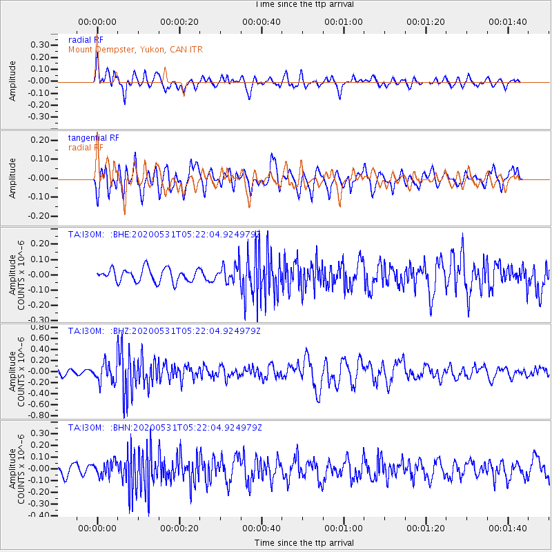
I30M Mount Dempster, Yukon, CAN - Earthquake Result Viewer
*The percent match for this event was below the threshold and hence no stack was calculated.
| Earthquake location: |
Southern Peru |
| Earthquake latitude/longitude: |
-15.3/-70.7 |
| Earthquake time(UTC): |
2020/05/31 (152) 05:09:35 GMT |
| Earthquake Depth: |
153 km |
| Earthquake Magnitude: |
6.0 mww |
| Earthquake Catalog/Contributor: |
NEIC PDE/us |
|
| Network: |
TA USArray Transportable Network (new EarthScope stations) |
| Station: |
I30M Mount Dempster, Yukon, CAN |
| Lat/Lon: |
65.22 N/136.38 W |
| Elevation: |
1399 m |
|
| Distance: |
94.0 deg |
| Az: |
337.352 deg |
| Baz: |
118.13 deg |
| Ray Param: |
$rayparam |
*The percent match for this event was below the threshold and hence was not used in the summary stack. |
|
| Radial Match: |
68.29203 % |
| Radial Bump: |
400 |
| Transverse Match: |
58.2063 % |
| Transverse Bump: |
400 |
| SOD ConfigId: |
21166931 |
| Insert Time: |
2020-06-14 05:32:16.087 +0000 |
| GWidth: |
2.5 |
| Max Bumps: |
400 |
| Tol: |
0.001 |
|
Signal To Noise
| Channel | StoN | STA | LTA |
| TA:I30M: :BHZ:20200531T05:22:04.924979Z | 2.4228897 | 1.8255939E-7 | 7.5347785E-8 |
| TA:I30M: :BHN:20200531T05:22:04.924979Z | 1.4567732 | 6.067909E-8 | 4.1653085E-8 |
| TA:I30M: :BHE:20200531T05:22:04.924979Z | 1.3587434 | 5.823834E-8 | 4.2861913E-8 |
| Arrivals |
| Ps | |
| PpPs | |
| PsPs/PpSs | |


