You are here: Home > Network List > KN - Kyrgyz Seismic Telemetry Network Stations List
> Station KZA KN.KZA > Earthquake Result Viewer
KZA KN.KZA - Earthquake Result Viewer
*The percent match for this event was below the threshold and hence no stack was calculated.
| Earthquake location: |
Minahassa Peninsula, Sulawesi |
| Earthquake latitude/longitude: |
0.1/120.7 |
| Earthquake time(UTC): |
2008/10/20 (294) 04:54:19 GMT |
| Earthquake Depth: |
102 km |
| Earthquake Magnitude: |
6.1 MB, 5.9 MW, 5.8 MW |
| Earthquake Catalog/Contributor: |
WHDF/NEIC |
|
| Network: |
KN Kyrgyz Seismic Telemetry Network |
| Station: |
KZA KN.KZA |
| Lat/Lon: |
42.08 N/75.25 E |
| Elevation: |
3520 m |
|
| Distance: |
58.4 deg |
| Az: |
321.509 deg |
| Baz: |
123.278 deg |
| Ray Param: |
$rayparam |
*The percent match for this event was below the threshold and hence was not used in the summary stack. |
|
| Radial Match: |
71.11045 % |
| Radial Bump: |
400 |
| Transverse Match: |
73.872986 % |
| Transverse Bump: |
400 |
| SOD ConfigId: |
2556 |
| Insert Time: |
2010-03-08 20:45:53.048 +0000 |
| GWidth: |
2.5 |
| Max Bumps: |
400 |
| Tol: |
0.001 |
|
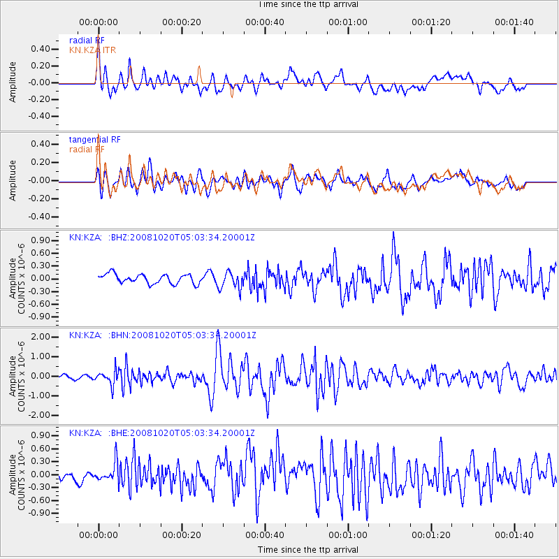
Signal To Noise
| Channel | StoN | STA | LTA |
| KN:KZA: :BHN:20081020T05:03:34.20001Z | 3.2758567 | 3.6763686E-7 | 1.1222617E-7 |
| KN:KZA: :BHE:20081020T05:03:34.20001Z | 1.4679612 | 2.3462107E-7 | 1.5982783E-7 |
| KN:KZA: :BHZ:20081020T05:03:34.20001Z | 1.8120376 | 1.9887202E-7 | 1.0975049E-7 |
| Arrivals |
| Ps | |
| PpPs | |
| PsPs/PpSs | |


