You are here: Home > Network List > UW - Pacific Northwest Regional Seismic Network Stations List
> Station UMAT Pilot Rock, OR, USA > Earthquake Result Viewer
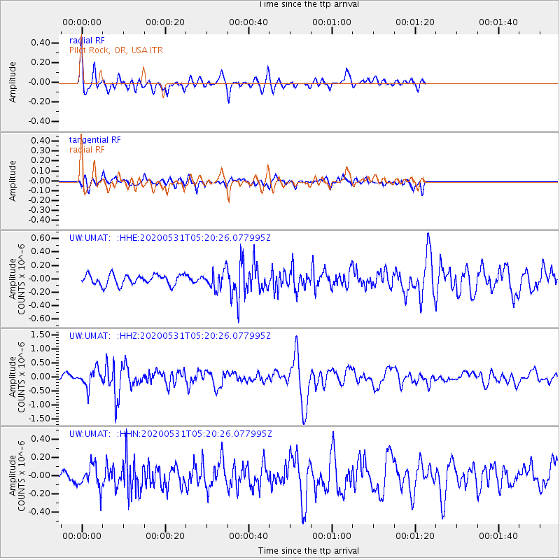
UMAT Pilot Rock, OR, USA - Earthquake Result Viewer
*The percent match for this event was below the threshold and hence no stack was calculated.
| Earthquake location: |
Southern Peru |
| Earthquake latitude/longitude: |
-15.3/-70.7 |
| Earthquake time(UTC): |
2020/05/31 (152) 05:09:35 GMT |
| Earthquake Depth: |
153 km |
| Earthquake Magnitude: |
6.0 mww |
| Earthquake Catalog/Contributor: |
NEIC PDE/us |
|
| Network: |
UW Pacific Northwest Regional Seismic Network |
| Station: |
UMAT Pilot Rock, OR, USA |
| Lat/Lon: |
45.29 N/118.96 W |
| Elevation: |
1318 m |
|
| Distance: |
74.5 deg |
| Az: |
326.839 deg |
| Baz: |
131.594 deg |
| Ray Param: |
$rayparam |
*The percent match for this event was below the threshold and hence was not used in the summary stack. |
|
| Radial Match: |
78.94495 % |
| Radial Bump: |
400 |
| Transverse Match: |
57.72526 % |
| Transverse Bump: |
400 |
| SOD ConfigId: |
21166931 |
| Insert Time: |
2020-06-14 05:37:32.920 +0000 |
| GWidth: |
2.5 |
| Max Bumps: |
400 |
| Tol: |
0.001 |
|
Signal To Noise
| Channel | StoN | STA | LTA |
| UW:UMAT: :HHZ:20200531T05:20:26.077995Z | 4.3517118 | 3.1040048E-7 | 7.1328365E-8 |
| UW:UMAT: :HHN:20200531T05:20:26.077995Z | 1.4075128 | 1.2744209E-7 | 9.054418E-8 |
| UW:UMAT: :HHE:20200531T05:20:26.077995Z | 1.7211299 | 1.3012324E-7 | 7.560338E-8 |
| Arrivals |
| Ps | |
| PpPs | |
| PsPs/PpSs | |


