You are here: Home > Network List > KN - Kyrgyz Seismic Telemetry Network Stations List
> Station KZA KN.KZA > Earthquake Result Viewer
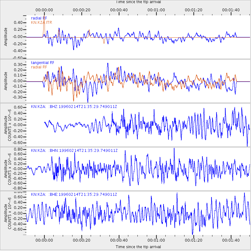
KZA KN.KZA - Earthquake Result Viewer
*The percent match for this event was below the threshold and hence no stack was calculated.
| Earthquake location: |
Southeast Of Honshu, Japan |
| Earthquake latitude/longitude: |
29.2/140.4 |
| Earthquake time(UTC): |
1996/02/14 (045) 21:26:56 GMT |
| Earthquake Depth: |
142 km |
| Earthquake Magnitude: |
5.9 MB |
| Earthquake Catalog/Contributor: |
WHDF/NEIC |
|
| Network: |
KN Kyrgyz Seismic Telemetry Network |
| Station: |
KZA KN.KZA |
| Lat/Lon: |
42.08 N/75.25 E |
| Elevation: |
3520 m |
|
| Distance: |
53.3 deg |
| Az: |
302.577 deg |
| Baz: |
81.668 deg |
| Ray Param: |
$rayparam |
*The percent match for this event was below the threshold and hence was not used in the summary stack. |
|
| Radial Match: |
54.88006 % |
| Radial Bump: |
400 |
| Transverse Match: |
38.48461 % |
| Transverse Bump: |
400 |
| SOD ConfigId: |
4480 |
| Insert Time: |
2010-03-08 20:46:01.384 +0000 |
| GWidth: |
2.5 |
| Max Bumps: |
400 |
| Tol: |
0.001 |
|
Signal To Noise
| Channel | StoN | STA | LTA |
| KN:KZA: :BHN:19960214T21:35:29.749011Z | 1.9750581 | 1.7438201E-7 | 8.829209E-8 |
| KN:KZA: :BHE:19960214T21:35:29.749011Z | 1.1786246 | 2.3717872E-7 | 2.0123348E-7 |
| KN:KZA: :BHZ:19960214T21:35:29.749011Z | 1.664088 | 1.4926333E-7 | 8.969677E-8 |
| Arrivals |
| Ps | |
| PpPs | |
| PsPs/PpSs | |


