You are here: Home > Network List > AV - Alaska Volcano Observatory Stations List
> Station AMKA Regional Station, Amchitka Island, Alaska > Earthquake Result Viewer
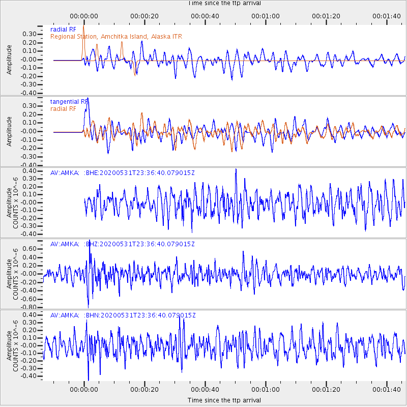
AMKA Regional Station, Amchitka Island, Alaska - Earthquake Result Viewer
*The percent match for this event was below the threshold and hence no stack was calculated.
| Earthquake location: |
South Of Fiji Islands |
| Earthquake latitude/longitude: |
-23.9/-176.6 |
| Earthquake time(UTC): |
2020/05/31 (152) 23:25:40 GMT |
| Earthquake Depth: |
100 km |
| Earthquake Magnitude: |
5.6 mww |
| Earthquake Catalog/Contributor: |
NEIC PDE/us |
|
| Network: |
AV Alaska Volcano Observatory |
| Station: |
AMKA Regional Station, Amchitka Island, Alaska |
| Lat/Lon: |
51.38 N/179.30 E |
| Elevation: |
116 m |
|
| Distance: |
75.0 deg |
| Az: |
357.32 deg |
| Baz: |
176.084 deg |
| Ray Param: |
$rayparam |
*The percent match for this event was below the threshold and hence was not used in the summary stack. |
|
| Radial Match: |
56.61743 % |
| Radial Bump: |
400 |
| Transverse Match: |
59.329872 % |
| Transverse Bump: |
400 |
| SOD ConfigId: |
21166931 |
| Insert Time: |
2020-06-14 23:29:35.642 +0000 |
| GWidth: |
2.5 |
| Max Bumps: |
400 |
| Tol: |
0.001 |
|
Signal To Noise
| Channel | StoN | STA | LTA |
| AV:AMKA: :BHZ:20200531T23:36:40.079015Z | 2.387846 | 3.1490057E-7 | 1.3187642E-7 |
| AV:AMKA: :BHN:20200531T23:36:40.079015Z | 1.343054 | 1.4469647E-7 | 1.07736895E-7 |
| AV:AMKA: :BHE:20200531T23:36:40.079015Z | 1.0954492 | 1.09215875E-7 | 9.9699626E-8 |
| Arrivals |
| Ps | |
| PpPs | |
| PsPs/PpSs | |


