You are here: Home > Network List > KN - Kyrgyz Seismic Telemetry Network Stations List
> Station KZA KN.KZA > Earthquake Result Viewer
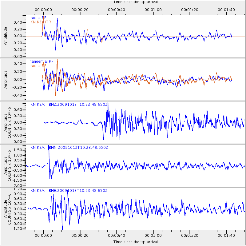
KZA KN.KZA - Earthquake Result Viewer
*The percent match for this event was below the threshold and hence no stack was calculated.
| Earthquake location: |
Kuril Islands |
| Earthquake latitude/longitude: |
44.6/149.1 |
| Earthquake time(UTC): |
2009/10/13 (286) 10:15:13 GMT |
| Earthquake Depth: |
40 km |
| Earthquake Magnitude: |
5.6 MB, 5.2 MS, 5.7 MW, 5.6 MW |
| Earthquake Catalog/Contributor: |
WHDF/NEIC |
|
| Network: |
KN Kyrgyz Seismic Telemetry Network |
| Station: |
KZA KN.KZA |
| Lat/Lon: |
42.08 N/75.25 E |
| Elevation: |
3520 m |
|
| Distance: |
52.1 deg |
| Az: |
294.937 deg |
| Baz: |
60.511 deg |
| Ray Param: |
$rayparam |
*The percent match for this event was below the threshold and hence was not used in the summary stack. |
|
| Radial Match: |
78.86901 % |
| Radial Bump: |
400 |
| Transverse Match: |
79.53086 % |
| Transverse Bump: |
400 |
| SOD ConfigId: |
2622 |
| Insert Time: |
2010-03-08 20:46:24.978 +0000 |
| GWidth: |
2.5 |
| Max Bumps: |
400 |
| Tol: |
0.001 |
|
Signal To Noise
| Channel | StoN | STA | LTA |
| KN:KZA: :BHN:20091013T10:23:48.650Z | 14.76002 | 7.0418133E-7 | 4.7708696E-8 |
| KN:KZA: :BHE:20091013T10:23:48.650Z | 3.3774817 | 2.9608967E-7 | 8.766581E-8 |
| KN:KZA: :BHZ:20091013T10:23:48.650Z | 6.414567 | 2.7805774E-7 | 4.3347857E-8 |
| Arrivals |
| Ps | |
| PpPs | |
| PsPs/PpSs | |


