You are here: Home > Network List > AV - Alaska Volcano Observatory Stations List
> Station SPCR Ckakachatna River, Mount Spurr, Alaska > Earthquake Result Viewer
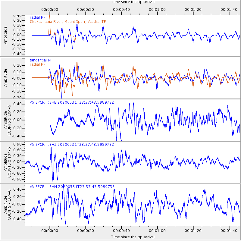
SPCR Ckakachatna River, Mount Spurr, Alaska - Earthquake Result Viewer
*The percent match for this event was below the threshold and hence no stack was calculated.
| Earthquake location: |
South Of Fiji Islands |
| Earthquake latitude/longitude: |
-23.9/-176.6 |
| Earthquake time(UTC): |
2020/05/31 (152) 23:25:40 GMT |
| Earthquake Depth: |
100 km |
| Earthquake Magnitude: |
5.6 mww |
| Earthquake Catalog/Contributor: |
NEIC PDE/us |
|
| Network: |
AV Alaska Volcano Observatory |
| Station: |
SPCR Ckakachatna River, Mount Spurr, Alaska |
| Lat/Lon: |
61.20 N/152.21 W |
| Elevation: |
984 m |
|
| Distance: |
87.0 deg |
| Az: |
11.536 deg |
| Baz: |
202.214 deg |
| Ray Param: |
$rayparam |
*The percent match for this event was below the threshold and hence was not used in the summary stack. |
|
| Radial Match: |
47.83126 % |
| Radial Bump: |
400 |
| Transverse Match: |
48.573418 % |
| Transverse Bump: |
400 |
| SOD ConfigId: |
21166931 |
| Insert Time: |
2020-06-14 23:30:31.789 +0000 |
| GWidth: |
2.5 |
| Max Bumps: |
400 |
| Tol: |
0.001 |
|
Signal To Noise
| Channel | StoN | STA | LTA |
| AV:SPCR: :BHZ:20200531T23:37:43.598973Z | 2.331465 | 5.259769E-7 | 2.2559928E-7 |
| AV:SPCR: :BHN:20200531T23:37:43.598973Z | 0.9345685 | 1.8321506E-7 | 1.9604241E-7 |
| AV:SPCR: :BHE:20200531T23:37:43.598973Z | 1.1864002 | 1.4994187E-7 | 1.263839E-7 |
| Arrivals |
| Ps | |
| PpPs | |
| PsPs/PpSs | |


