You are here: Home > Network List > G - GEOSCOPE Stations List
> Station INU Inuyama, Japan > Earthquake Result Viewer
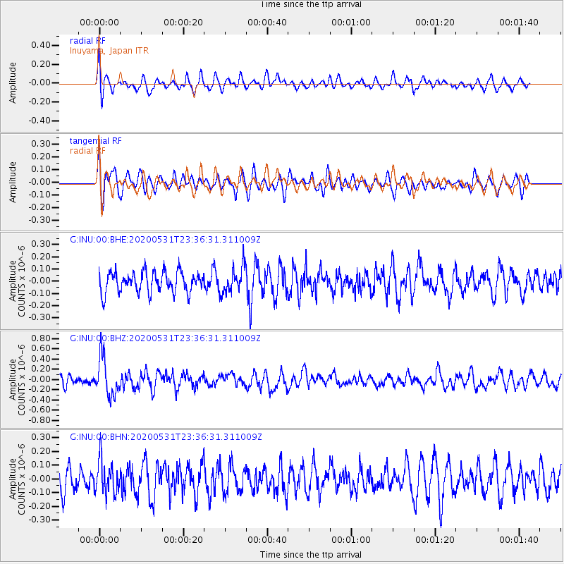
INU Inuyama, Japan - Earthquake Result Viewer
*The percent match for this event was below the threshold and hence no stack was calculated.
| Earthquake location: |
South Of Fiji Islands |
| Earthquake latitude/longitude: |
-23.9/-176.6 |
| Earthquake time(UTC): |
2020/05/31 (152) 23:25:40 GMT |
| Earthquake Depth: |
100 km |
| Earthquake Magnitude: |
5.6 mww |
| Earthquake Catalog/Contributor: |
NEIC PDE/us |
|
| Network: |
G GEOSCOPE |
| Station: |
INU Inuyama, Japan |
| Lat/Lon: |
35.35 N/137.03 E |
| Elevation: |
132 m |
|
| Distance: |
73.5 deg |
| Az: |
321.866 deg |
| Baz: |
136.248 deg |
| Ray Param: |
$rayparam |
*The percent match for this event was below the threshold and hence was not used in the summary stack. |
|
| Radial Match: |
67.400406 % |
| Radial Bump: |
400 |
| Transverse Match: |
49.843586 % |
| Transverse Bump: |
400 |
| SOD ConfigId: |
21166931 |
| Insert Time: |
2020-06-14 23:34:46.997 +0000 |
| GWidth: |
2.5 |
| Max Bumps: |
400 |
| Tol: |
0.001 |
|
Signal To Noise
| Channel | StoN | STA | LTA |
| G:INU:00:BHZ:20200531T23:36:31.311009Z | 4.192069 | 3.8295357E-7 | 9.135192E-8 |
| G:INU:00:BHN:20200531T23:36:31.311009Z | 1.1821353 | 1.2256552E-7 | 1.0368146E-7 |
| G:INU:00:BHE:20200531T23:36:31.311009Z | 1.3195359 | 1.0948548E-7 | 8.297272E-8 |
| Arrivals |
| Ps | |
| PpPs | |
| PsPs/PpSs | |


