You are here: Home > Network List > GS - US Geological Survey Networks Stations List
> Station DEC08 Decatur Surface Seismic Site, Decatur, IL, USA > Earthquake Result Viewer
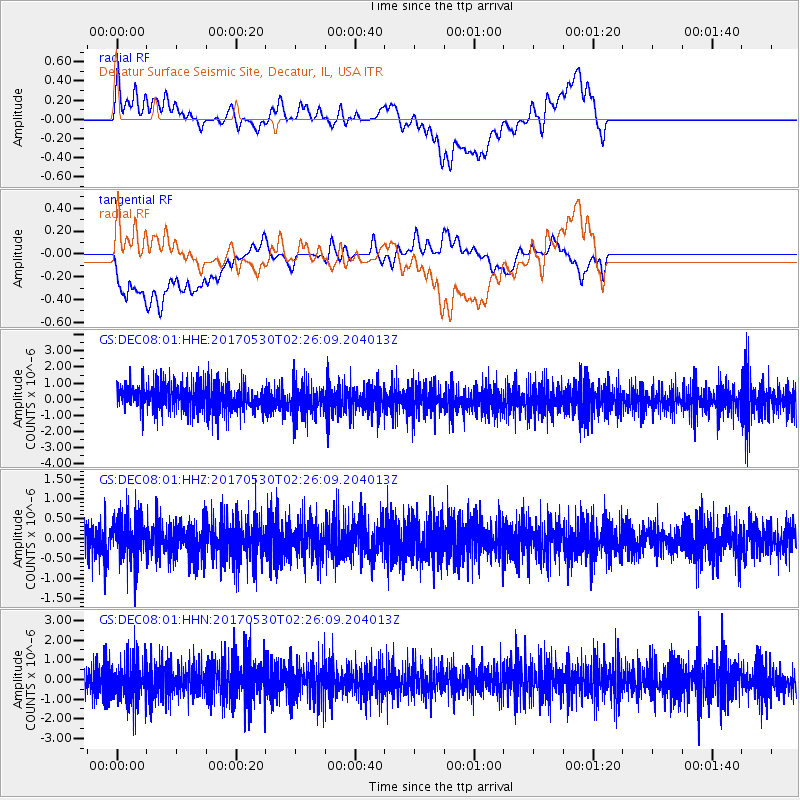
DEC08 Decatur Surface Seismic Site, Decatur, IL, USA - Earthquake Result Viewer
*The percent match for this event was below the threshold and hence no stack was calculated.
| Earthquake location: |
Kenai Peninsula, Alaska |
| Earthquake latitude/longitude: |
60.8/-151.8 |
| Earthquake time(UTC): |
2017/05/30 (150) 02:18:45 GMT |
| Earthquake Depth: |
78 km |
| Earthquake Magnitude: |
5.2 Mww |
| Earthquake Catalog/Contributor: |
NEIC PDE/ak |
|
| Network: |
GS US Geological Survey Networks |
| Station: |
DEC08 Decatur Surface Seismic Site, Decatur, IL, USA |
| Lat/Lon: |
39.86 N/88.92 W |
| Elevation: |
210 m |
|
| Distance: |
43.3 deg |
| Az: |
89.415 deg |
| Baz: |
320.485 deg |
| Ray Param: |
$rayparam |
*The percent match for this event was below the threshold and hence was not used in the summary stack. |
|
| Radial Match: |
19.3737 % |
| Radial Bump: |
400 |
| Transverse Match: |
21.477682 % |
| Transverse Bump: |
400 |
| SOD ConfigId: |
2140511 |
| Insert Time: |
2017-06-20 22:30:59.825 +0000 |
| GWidth: |
2.5 |
| Max Bumps: |
400 |
| Tol: |
0.001 |
|
Signal To Noise
| Channel | StoN | STA | LTA |
| GS:DEC08:01:HHZ:20170530T02:26:09.204013Z | 1.3323425 | 5.3373765E-7 | 4.0060092E-7 |
| GS:DEC08:01:HHN:20170530T02:26:09.204013Z | 1.3061752 | 1.0700809E-6 | 8.192476E-7 |
| GS:DEC08:01:HHE:20170530T02:26:09.204013Z | 1.1585017 | 9.937313E-7 | 8.577728E-7 |
| Arrivals |
| Ps | |
| PpPs | |
| PsPs/PpSs | |


