You are here: Home > Network List > TA - USArray Transportable Network (new EarthScope stations) Stations List
> Station F21K Alatna River, AK, USA > Earthquake Result Viewer
F21K Alatna River, AK, USA - Earthquake Result Viewer
*The percent match for this event was below the threshold and hence no stack was calculated.
| Earthquake location: |
South Of Fiji Islands |
| Earthquake latitude/longitude: |
-23.9/-176.6 |
| Earthquake time(UTC): |
2020/05/31 (152) 23:25:40 GMT |
| Earthquake Depth: |
100 km |
| Earthquake Magnitude: |
5.6 mww |
| Earthquake Catalog/Contributor: |
NEIC PDE/us |
|
| Network: |
TA USArray Transportable Network (new EarthScope stations) |
| Station: |
F21K Alatna River, AK, USA |
| Lat/Lon: |
67.22 N/153.48 W |
| Elevation: |
597 m |
|
| Distance: |
92.4 deg |
| Az: |
8.789 deg |
| Baz: |
201.054 deg |
| Ray Param: |
$rayparam |
*The percent match for this event was below the threshold and hence was not used in the summary stack. |
|
| Radial Match: |
40.62589 % |
| Radial Bump: |
388 |
| Transverse Match: |
55.782795 % |
| Transverse Bump: |
400 |
| SOD ConfigId: |
21166931 |
| Insert Time: |
2020-06-14 23:40:18.556 +0000 |
| GWidth: |
2.5 |
| Max Bumps: |
400 |
| Tol: |
0.001 |
|
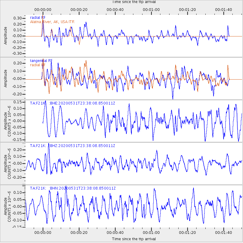
Signal To Noise
| Channel | StoN | STA | LTA |
| TA:F21K: :BHZ:20200531T23:38:08.850011Z | 2.8389983 | 1.2842258E-7 | 4.5235172E-8 |
| TA:F21K: :BHN:20200531T23:38:08.850011Z | 1.2547916 | 6.8402386E-8 | 5.4512945E-8 |
| TA:F21K: :BHE:20200531T23:38:08.850011Z | 0.84342647 | 5.7741207E-8 | 6.8460274E-8 |
| Arrivals |
| Ps | |
| PpPs | |
| PsPs/PpSs | |


