You are here: Home > Network List > GS - US Geological Survey Networks Stations List
> Station OK051 E0350 and S34600 Roads, Ralston, OK > Earthquake Result Viewer
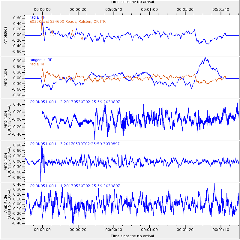
OK051 E0350 and S34600 Roads, Ralston, OK - Earthquake Result Viewer
*The percent match for this event was below the threshold and hence no stack was calculated.
| Earthquake location: |
Kenai Peninsula, Alaska |
| Earthquake latitude/longitude: |
60.8/-151.8 |
| Earthquake time(UTC): |
2017/05/30 (150) 02:18:45 GMT |
| Earthquake Depth: |
78 km |
| Earthquake Magnitude: |
5.2 Mww |
| Earthquake Catalog/Contributor: |
NEIC PDE/ak |
|
| Network: |
GS US Geological Survey Networks |
| Station: |
OK051 E0350 and S34600 Roads, Ralston, OK |
| Lat/Lon: |
36.51 N/96.84 W |
| Elevation: |
263 m |
|
| Distance: |
42.0 deg |
| Az: |
99.708 deg |
| Baz: |
323.189 deg |
| Ray Param: |
$rayparam |
*The percent match for this event was below the threshold and hence was not used in the summary stack. |
|
| Radial Match: |
54.85948 % |
| Radial Bump: |
400 |
| Transverse Match: |
57.333668 % |
| Transverse Bump: |
400 |
| SOD ConfigId: |
2140511 |
| Insert Time: |
2017-06-20 22:31:20.625 +0000 |
| GWidth: |
2.5 |
| Max Bumps: |
400 |
| Tol: |
0.001 |
|
Signal To Noise
| Channel | StoN | STA | LTA |
| GS:OK051:00:HHZ:20170530T02:25:59.303989Z | 4.73308 | 4.0524347E-7 | 8.5619405E-8 |
| GS:OK051:00:HH1:20170530T02:25:59.303989Z | 1.3914528 | 1.5644707E-7 | 1.12434336E-7 |
| GS:OK051:00:HH2:20170530T02:25:59.303989Z | 2.1016836 | 2.002795E-7 | 9.529479E-8 |
| Arrivals |
| Ps | |
| PpPs | |
| PsPs/PpSs | |


