You are here: Home > Network List > TA - USArray Transportable Network (new EarthScope stations) Stations List
> Station M16K Timber Creek, AK, USA > Earthquake Result Viewer
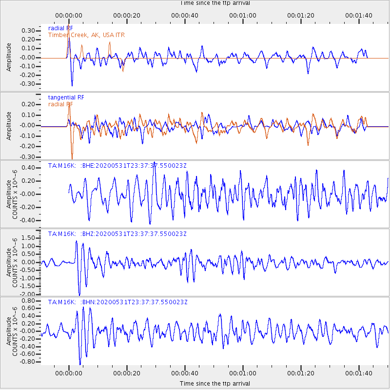
M16K Timber Creek, AK, USA - Earthquake Result Viewer
*The percent match for this event was below the threshold and hence no stack was calculated.
| Earthquake location: |
South Of Fiji Islands |
| Earthquake latitude/longitude: |
-23.9/-176.6 |
| Earthquake time(UTC): |
2020/05/31 (152) 23:25:40 GMT |
| Earthquake Depth: |
100 km |
| Earthquake Magnitude: |
5.6 mww |
| Earthquake Catalog/Contributor: |
NEIC PDE/us |
|
| Network: |
TA USArray Transportable Network (new EarthScope stations) |
| Station: |
M16K Timber Creek, AK, USA |
| Lat/Lon: |
61.02 N/158.96 W |
| Elevation: |
394 m |
|
| Distance: |
85.8 deg |
| Az: |
8.493 deg |
| Baz: |
196.121 deg |
| Ray Param: |
$rayparam |
*The percent match for this event was below the threshold and hence was not used in the summary stack. |
|
| Radial Match: |
67.644775 % |
| Radial Bump: |
400 |
| Transverse Match: |
54.990475 % |
| Transverse Bump: |
400 |
| SOD ConfigId: |
21166931 |
| Insert Time: |
2020-06-14 23:41:09.361 +0000 |
| GWidth: |
2.5 |
| Max Bumps: |
400 |
| Tol: |
0.001 |
|
Signal To Noise
| Channel | StoN | STA | LTA |
| TA:M16K: :BHZ:20200531T23:37:37.550023Z | 4.188281 | 8.259692E-7 | 1.972096E-7 |
| TA:M16K: :BHN:20200531T23:37:37.550023Z | 2.7563808 | 3.4125983E-7 | 1.2380723E-7 |
| TA:M16K: :BHE:20200531T23:37:37.550023Z | 1.4553561 | 2.2616126E-7 | 1.5539925E-7 |
| Arrivals |
| Ps | |
| PpPs | |
| PsPs/PpSs | |


