
TKM2 KN.TKM2 - Earthquake Result Viewer
| ||||||||||||||||||
| ||||||||||||||||||
| ||||||||||||||||||
|
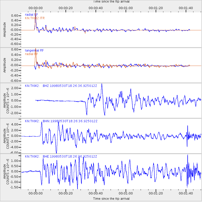
Signal To Noise
| Channel | StoN | STA | LTA |
| KN:TKM2: :BHN:19980530T18:26:36.925012Z | 45.745144 | 1.687431E-6 | 3.6887652E-8 |
| KN:TKM2: :BHE:19980530T18:26:36.925012Z | 6.281844 | 4.262409E-7 | 6.785283E-8 |
| KN:TKM2: :BHZ:19980530T18:26:36.925012Z | 13.784449 | 7.536217E-7 | 5.4671876E-8 |
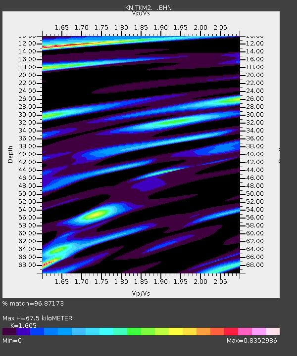
| Arrivals | |
| Ps | 6.9 SECOND |
| PpPs | 26 SECOND |
| PsPs/PpSs | 33 SECOND |

