
TKM2 KN.TKM2 - Earthquake Result Viewer
| ||||||||||||||||||
| ||||||||||||||||||
| ||||||||||||||||||
|
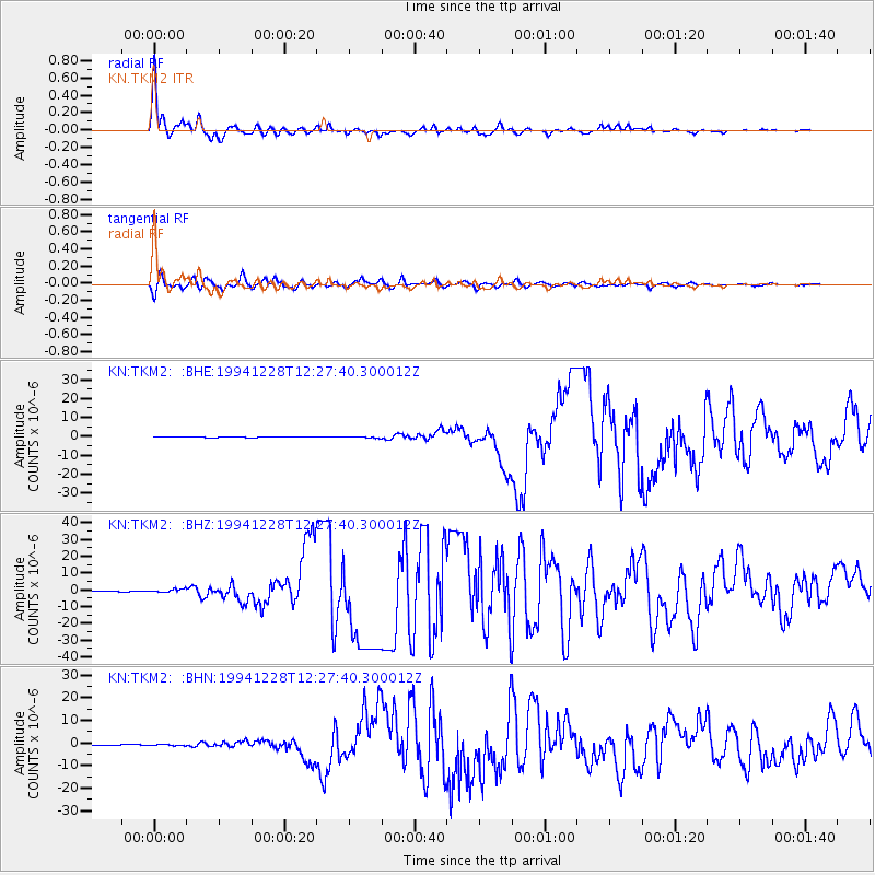
Signal To Noise
| Channel | StoN | STA | LTA |
| KN:TKM2: :BHZ:19941228T12:27:40.300012Z | 4.924763 | 9.899934E-7 | 2.0102355E-7 |
| KN:TKM2: :BHN:19941228T12:27:40.300012Z | 3.8979 | 2.1119065E-7 | 5.418062E-8 |
| KN:TKM2: :BHE:19941228T12:27:40.300012Z | 4.0814486 | 4.270173E-7 | 1.04623965E-7 |
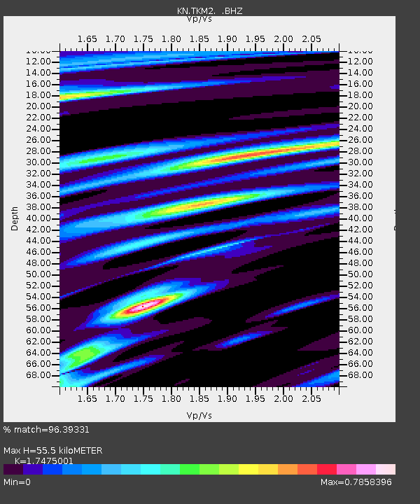
| Arrivals | |
| Ps | 7.0 SECOND |
| PpPs | 23 SECOND |
| PsPs/PpSs | 30 SECOND |

