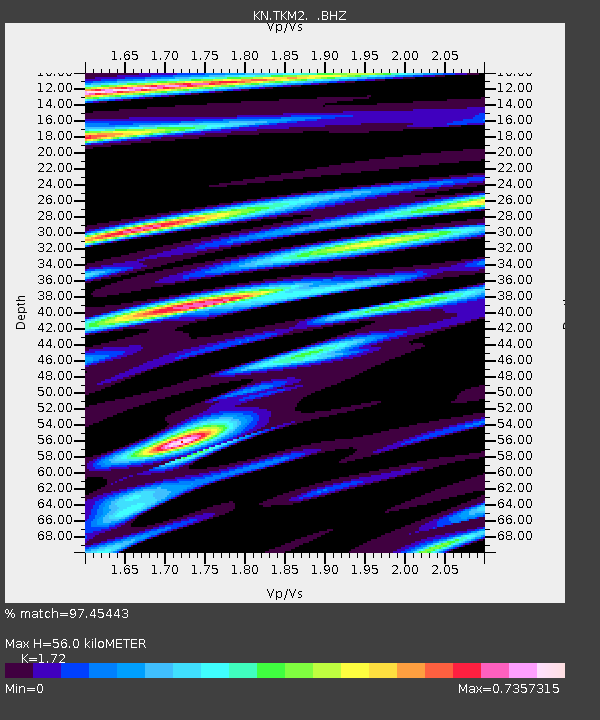
TKM2 KN.TKM2 - Earthquake Result Viewer
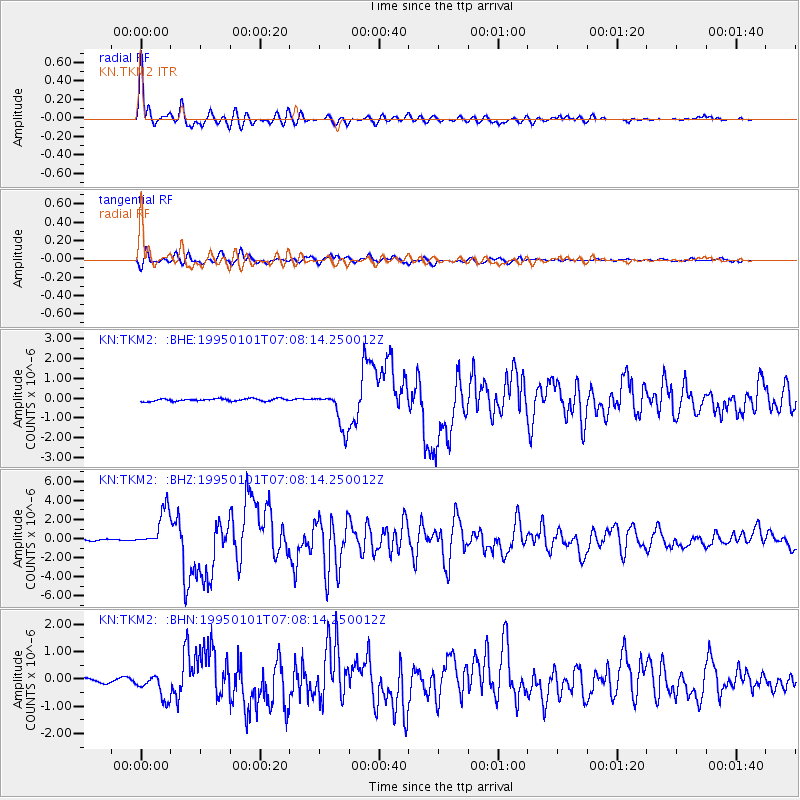
Earthquake location: Off East Coast Of Honshu, Japan
Earthquake latitude/longitude: 40.6/143.6
Earthquake time(UTC): 1995/01/01 (001) 06:59:54 GMT
Earthquake Depth: 10 km
Earthquake Magnitude: 5.7 MB, 6.2 MS, 5.9 UNKNOWN, 6.4 MW
Earthquake Catalog/Contributor: WHDF/NEIC
Network: KN Kyrgyz Seismic Telemetry Network
Station: TKM2 KN.TKM2
Lat/Lon: 42.92 N/75.60 E
Elevation: 2020 m
Distance: 49.5 deg
Az: 296.381 deg
Baz: 68.145 deg
Ray Param: 0.068672836
Estimated Moho Depth: 56.0 km
Estimated Crust Vp/Vs: 1.72
Assumed Crust Vp: 6.306 km/s
Estimated Crust Vs: 3.666 km/s
Estimated Crust Poisson's Ratio: 0.24
Radial Match: 97.45443 %
Radial Bump: 400
Transverse Match: 91.367775 %
Transverse Bump: 400
SOD ConfigId: 4480
Insert Time: 2010-03-08 20:49:15.684 +0000
GWidth: 2.5
Max Bumps: 400
Tol: 0.001

Signal To Noise

ChannelStoNSTALTA
KN:TKM2: :BHZ:19950101T07:08:14.250012Z24.4392911.9792094E-68.0984734E-8
KN:TKM2: :BHN:19950101T07:08:14.250012Z6.0110544.6548345E-77.743791E-8
KN:TKM2: :BHE:19950101T07:08:14.250012Z14.8806059.573079E-76.4332596E-8
Arrivals
Ps6.8 SECOND
PpPs23 SECOND
PsPs/PpSs30 SECOND