
TKM2 KN.TKM2 - Earthquake Result Viewer
| ||||||||||||||||||
| ||||||||||||||||||
| ||||||||||||||||||
|
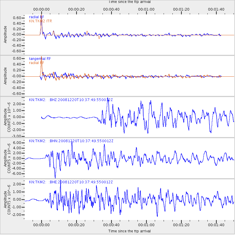
Signal To Noise
| Channel | StoN | STA | LTA |
| KN:TKM2: :BHN:20081220T10:37:49.550012Z | 7.156116 | 9.5108203E-7 | 1.3290479E-7 |
| KN:TKM2: :BHE:20081220T10:37:49.550012Z | 1.515702 | 1.9329015E-7 | 1.2752517E-7 |
| KN:TKM2: :BHZ:20081220T10:37:49.550012Z | 4.3459888 | 4.1145316E-7 | 9.467423E-8 |
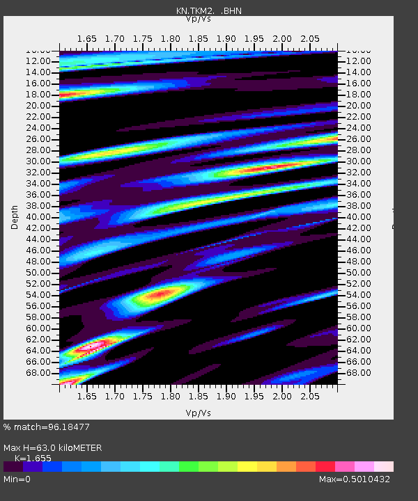
| Arrivals | |
| Ps | 6.9 SECOND |
| PpPs | 25 SECOND |
| PsPs/PpSs | 32 SECOND |

