You are here: Home > Network List > AV - Alaska Volcano Observatory Stations List
> Station SPCR Ckakachatna River, Mount Spurr, Alaska > Earthquake Result Viewer
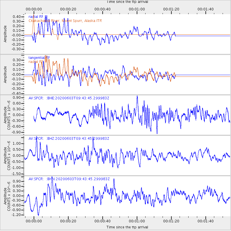
SPCR Ckakachatna River, Mount Spurr, Alaska - Earthquake Result Viewer
*The percent match for this event was below the threshold and hence no stack was calculated.
| Earthquake location: |
South Of Fiji Islands |
| Earthquake latitude/longitude: |
-24.7/-176.6 |
| Earthquake time(UTC): |
2020/06/03 (155) 09:31:36 GMT |
| Earthquake Depth: |
88 km |
| Earthquake Magnitude: |
5.9 mww |
| Earthquake Catalog/Contributor: |
NEIC PDE/us |
|
| Network: |
AV Alaska Volcano Observatory |
| Station: |
SPCR Ckakachatna River, Mount Spurr, Alaska |
| Lat/Lon: |
61.20 N/152.21 W |
| Elevation: |
984 m |
|
| Distance: |
87.8 deg |
| Az: |
11.54 deg |
| Baz: |
202.072 deg |
| Ray Param: |
$rayparam |
*The percent match for this event was below the threshold and hence was not used in the summary stack. |
|
| Radial Match: |
52.41153 % |
| Radial Bump: |
400 |
| Transverse Match: |
63.10432 % |
| Transverse Bump: |
400 |
| SOD ConfigId: |
21166931 |
| Insert Time: |
2020-06-17 09:36:31.439 +0000 |
| GWidth: |
2.5 |
| Max Bumps: |
400 |
| Tol: |
0.001 |
|
Signal To Noise
| Channel | StoN | STA | LTA |
| AV:SPCR: :BHZ:20200603T09:43:45.299983Z | 2.1129837 | 5.9812254E-7 | 2.8307014E-7 |
| AV:SPCR: :BHN:20200603T09:43:45.299983Z | 1.896557 | 8.3744413E-7 | 4.4156022E-7 |
| AV:SPCR: :BHE:20200603T09:43:45.299983Z | 1.2883682 | 2.2334733E-7 | 1.7335675E-7 |
| Arrivals |
| Ps | |
| PpPs | |
| PsPs/PpSs | |


